

1740 – J. B. Homann – Regni Poloniae Magnique Ducatus Lithuaniae
650 €
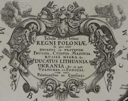
Title: “Regni Poloniae Magnique Ducatus Lithuaniae Nova et exacta tabula ad memtem Starovolcy descripta…”
Description:
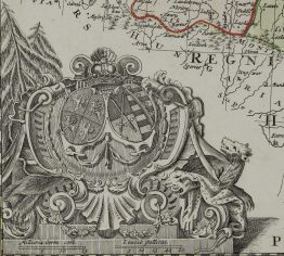
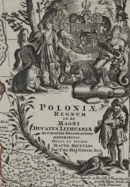
Attractive original hand colored antique map of Lithuania, Latvia, Poland, Prussia and Belarus. A gorgeous allegorical cartouche fills the Baltic Sea and features Ares, god of war, holding both a spear and a laurel wreath, the Polish-Lithuanian coat of arms under Wettin dynasty, and beehives symbolizing industry. Map is dated 1739.
Map comes from the atlas “Grosser Atlas ueber die ganze Welt“ published in Nuremberg 1740.
Cartographer: Johann Baptist Homann (1664-1724)
Sheet size: 60,7 x 53,8 cm
Year: 1740
Technique: copper engraving
Condition:
Good condition, original hand coloring. Watermarked paper. Few light water stains and marginal splits present.
This is an original antique map published in 1740 and NOT a modern copy or reprint
On your request I will provide a Certificate of Authenticity
In stock


")


