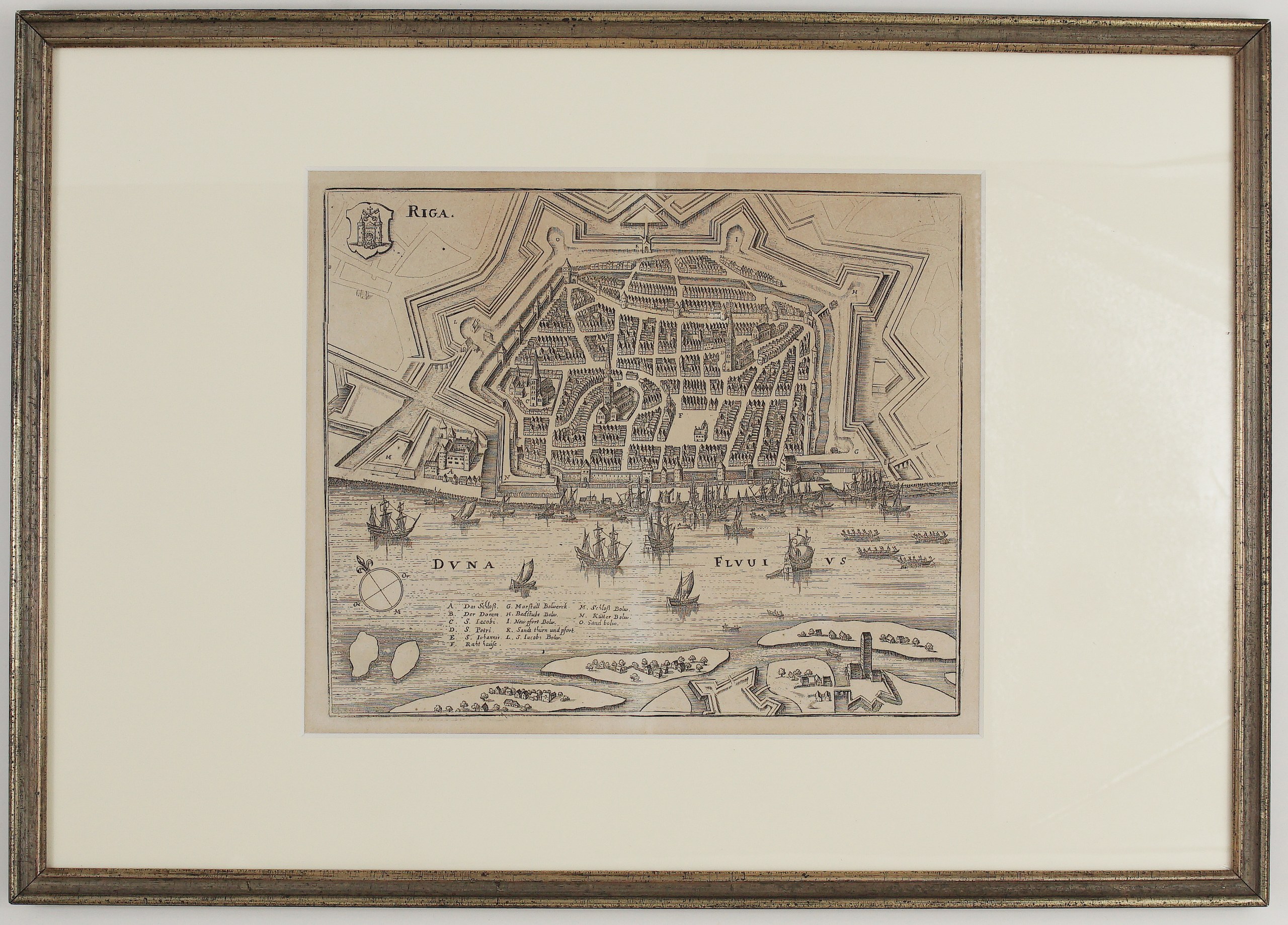
1646 – M. Merian – Riga
170 €
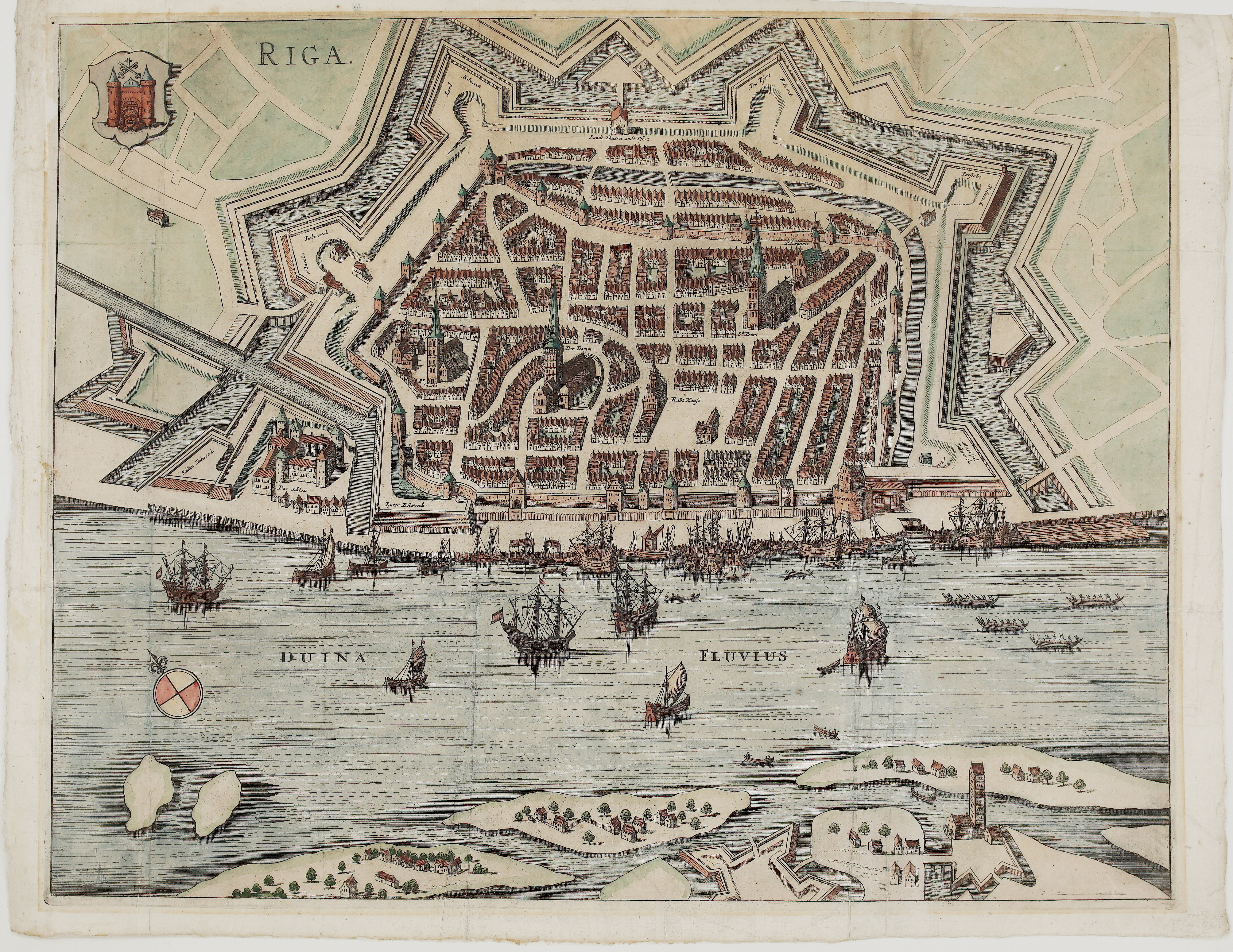
Title: “Riga.”
Description:
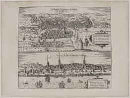
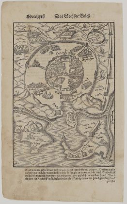
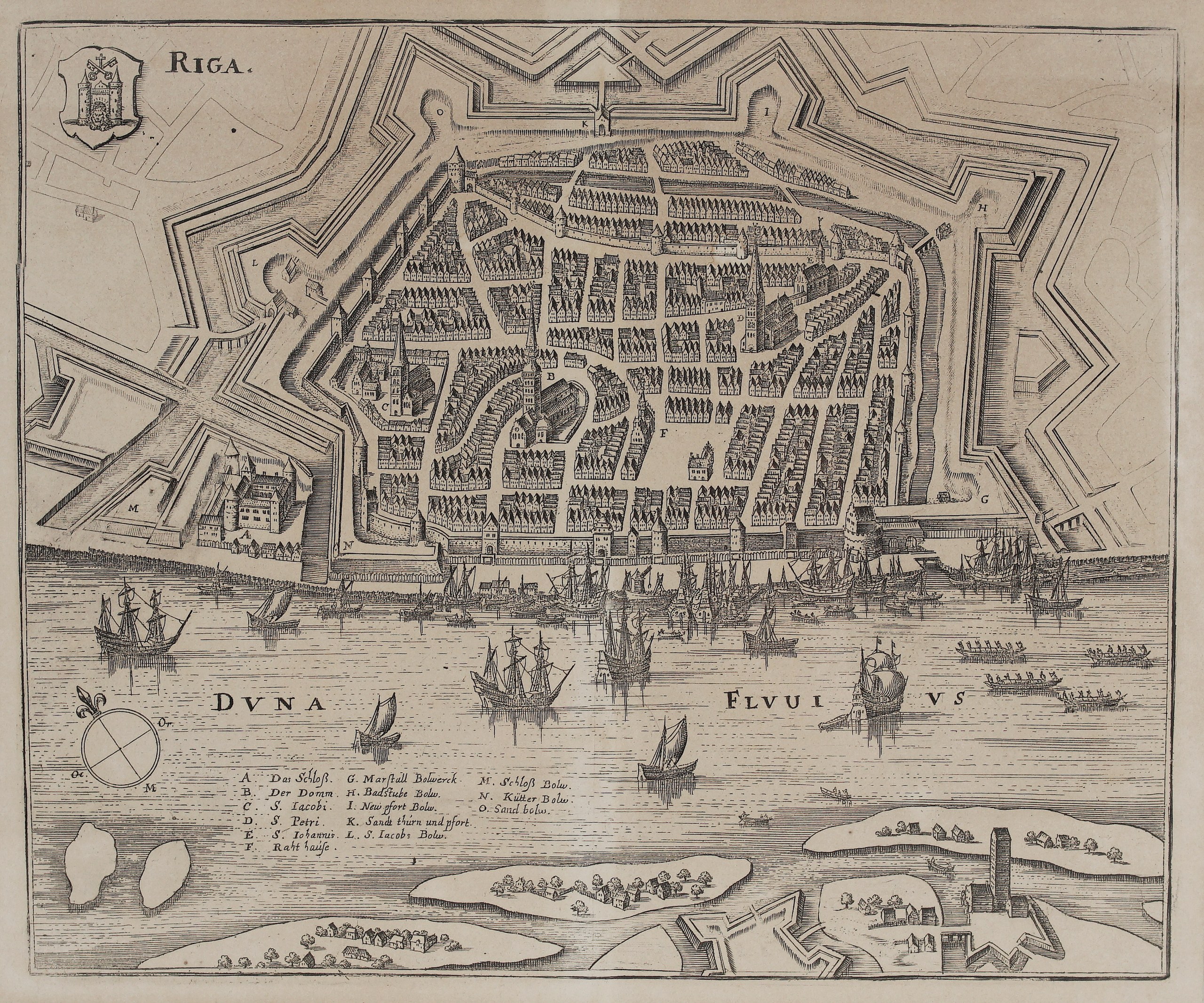
This is a fine bird’s-eye plan of Riga, the capital of Livonia, engraved by Matthäus Merian the Elder for Johann Ludwig Gottfried’s world description Neuwe Archontologia Cosmica.
The plan shows the city as it was under Swedish rule after Gustavus Adolphus captured it in 1621. The medieval walled town, with its tightly packed gabled houses, is encircled by a ring of modern bastions and moats. Along the Daugava (“Duna Fluvius”) a forest of masts crowds the quay, merchant ships and galleys ride on the river, and fortified islands and outworks lie on the opposite bank.
A key lists fifteen places, including:
- Buildings: the Castle (“Das Schloß”), the Cathedral (“Der Domm”), St James, St Peter, St John and the Town Hall.
- Bastions and gates: the Marstall, Badstube, Neupforte, Sand Tower and Gate, St James, Castle, Kütter and Sand bastions.
The arms of Riga, two towers with crossed keys and a lion’s head in the gate, stand at upper left, and a compass rose sits on the river at left.
Cartographer/Artist: Matthäus Merian the Elder (1593–1650)
Publisher: Matthäus Merian, Frankfurt am Main
Atlas: J. L. Gottfried, Neuwe Archontologia Cosmica
Frame size: 51,5 x 36,5 cm
Year: 1646
Technique: copper engraving
Reference: Museum of the History of Riga and Navigation, graphics collection (Merian, Neuwe Archontologia Cosmica, 1646)
Condition:
Good. Strong, dark impression. The paper is evenly toned. It is framed under a cream mount in a silver-gilt frame, behind glass.
This is an original antique map published in 1646 and NOT a modern copy or reprint
On your request we will provide a Certificate of Authenticity
In stock