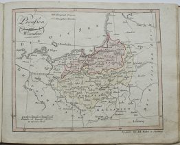
1757 – G. L. Le Rouge – Le Royaume de Prusse
120 €
Title: “LE ROYAUME DE PRUSSE. A Paris chez le Rouge 1757.”
Description:
Small, but very detailed antique map of Prussia. The map features hand-colored borders that delineate different administrative or historical regions of the era. At the time of its publication, Prussia was a significant European power during the Seven Years’ War (1756–1763), which may have influenced the demand for such detailed geographical information.
Comes from Le Rouge atlas “Atlas Nouveau Portatif…” issued in Paris, 1757.
Cartographer: Georges-Louis Le Rouge (1712 – 1790)
Sheet size: 34,0 x 23,2 cm
Year: 1757
Technique: copper engraving
Condition:
Very good condition. Contemporary coloring, wide margins, watermarked paper.
This is an original antique map published in 1757 and NOT a modern copy or reprint
On your request I will provide a Certificate of Authenticity
In stock