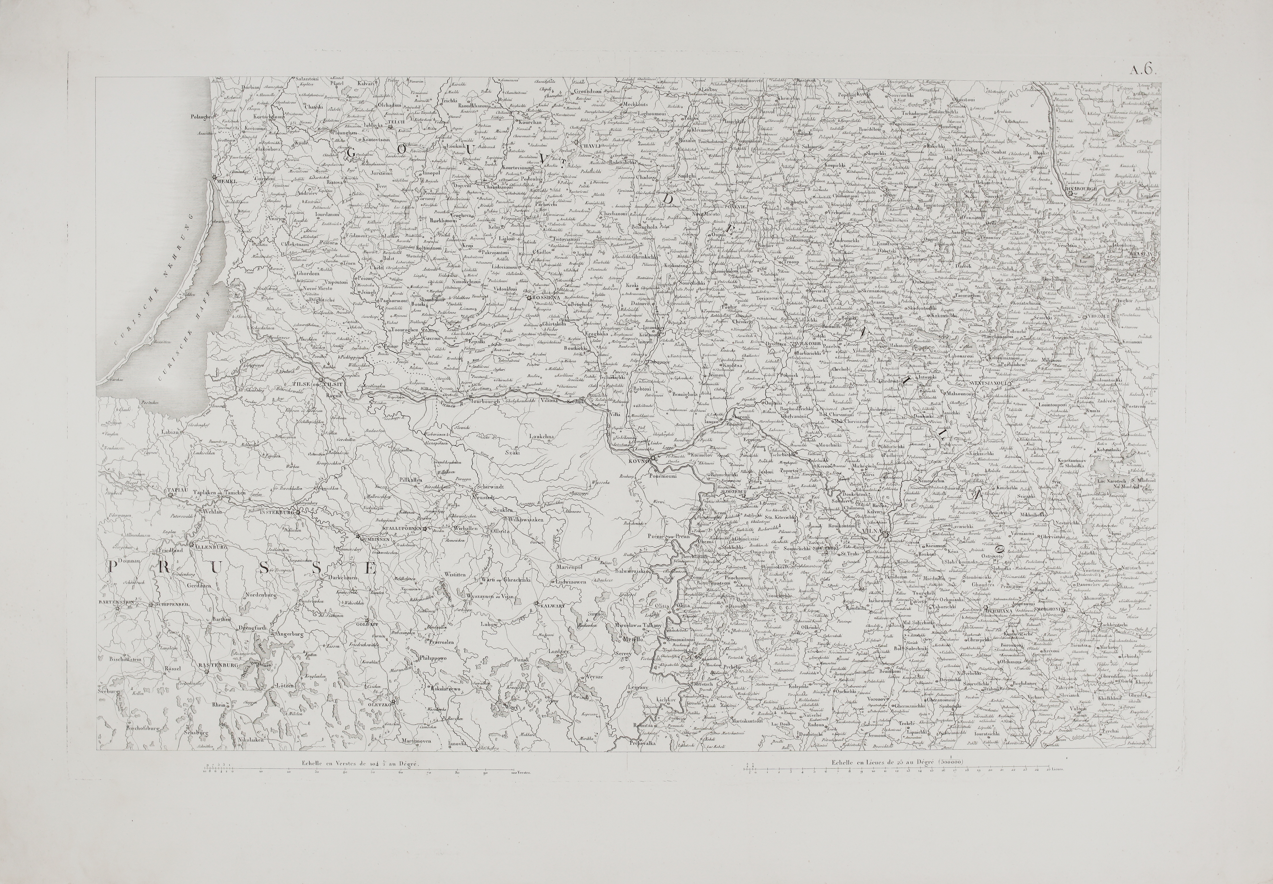
1812 – P. A. F. Tardieu – Carte de la Russie Europeenne A6
350 €
Title: “Carte de la Russie Européenne en LXXVII feuilles exécutée au Dépôt général de la Guerre”
Description:
Very rare, large size and extremely detailed antique map from one of the more unusual cartographic projects of the Napoleonic era: a complete map of European Russia, translated and re-engraved in France from a Russian survey in 104 sheets. The French army’s own mapping office, the Dépôt général de la Guerre in Paris, issued the result as Carte de la Russie Européenne en LXXVII feuilles between 1812 and 1814 — 77 sheets at a scale of 1:500,000, assembling into a composite map roughly 2.7 by 2.7 meters when laid out in full. This sheet, numbered A.6, covers the western borderlands around Memel, Tilsit, Kaunas and Vilnius, now Lithuania teritory.
The project’s timing is part of what makes it compelling: work on the 77-sheet edition began during the 1812 campaign itself, while Napoleon’s army was still in Russia. The earliest sheets reportedly sold well enough in Paris that Napoleon personally ordered, on 30 July 1812, that nothing further be released from the war depots — an order that reads, in hindsight, like an acknowledgment that the map amounted to detailed Russian military intelligence now in French hands.
Sheet A.6 itself carries both a Russian and a French scale — “Echelle en Verstes de 104½ au Degré” and “Echelle en Lieues de 25 au Degré (500000)” — reflecting its origin as a translated Russian survey adapted for French staff officers. Towns appear in French transliteration of their Russian-administered names (Kovno, Vilna, Rossiena), while the Curonian Spit and Lagoon keep their German forms (Curische Nehrung, Curisches Haff) right at the Prussian frontier. The spaced lettering “GOUV.” running across the sheet continues onto neighboring sheets as “Gouvernement de Wilna” — correct for 1812, since Kaunas and Samogitia were not split off into a separate Kovno Governorate until 1842–43.
Sheets from this series are occasionally catalogued under the geographer Edme Mentelle, but that attribution doesn’t hold up well: Mentelle’s own major cartographic project of the period, the Atlas national de la France produced with Pierre-Grégoire Chanlaire, covered the French departments, not Russia. The Bibliothèque nationale de France and the University of Bern both catalogue this series under the Dépôt général de la Guerre alone, with no individual geographer credited.
Complete 77-sheet sets survive mainly in institutional collections such as the BnF and Bern; individual sheets reach the market far more often, and one centered on the Lithuanian heartland — Kaunas, Vilnius, Trakai — has obvious appeal for collectors of Napoleonic history or Baltic regional cartography alike.
Provenance & references:
- Bibliothèque nationale de France (Gallica), complete 77-sheet set, shelfmark btv1b5970618b
- Universitätsbibliothek Bern (e-rara.ch), SOB RoEu fol 129, DOI 10.3931/e-rara-88626
- Edme Mentelle & Pierre-Grégoire Chanlaire, Atlas national de la France, 1790–1811 (Mentelle’s own documented cartographic project of the period — cited here to explain, not support, the alternate attribution sometimes seen in the trade)
Cartographer: Pierre Antoine François Tardieu (1784 – 1869)
Publisher: Dépôt général de la Guerre, Paris
Sheet size: 94.8 x 68.0 cm
Year: 1812
Technique: lithography
Condition:
In good condition, wide margins.
This is an original antique map published in 1812 and NOT a modern copy or reprint
On your request I will provide a Certificate of Authenticity
In stock