1578-1588 – S. Munster – Von dem Königreich Poland
300 €
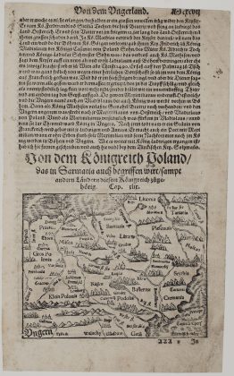
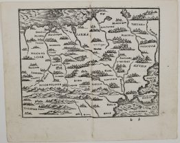
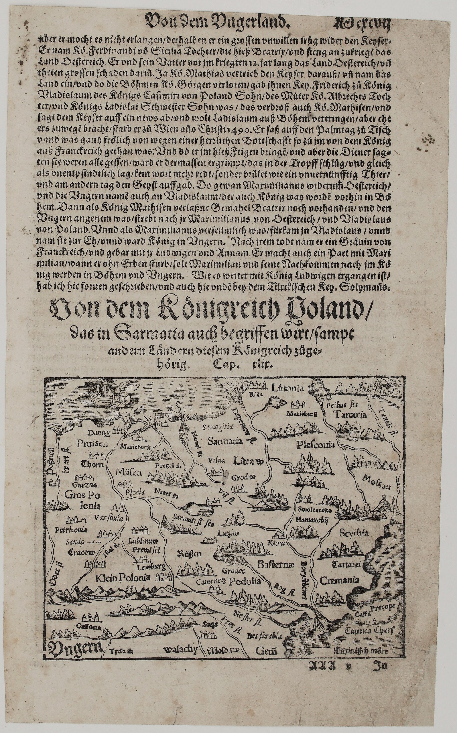
Title: Von dem Königreich Poland, das in Sarmatia auch begriffen wirt, sampt andern Ländern diesem Königreich zugehörig
(Of the Kingdom of Poland, which is also included in Sarmatia, together with other Lands belonging to this Kingdom)
Description:
This is an original woodcut map from Sebastian Münster’s Cosmographey, published in Basel by the Henricpetri press. It opens chapter 49 of the fourth book, on the Kingdom of Poland, and is one of the earliest printed maps to show the Polish–Lithuanian lands as a separate region. Unknown issue of Sebastian Münster’s Cosmographey.
The map covers the whole region from the Baltic to the Black Sea:
- Lithuania (Littaw): Vilnius (Vilna), Grodno and Samogitia, beneath the name Sarmatia.
- To the north: Livonia with Riga, and Pskov (Plescouia) and Moscow.
- To the west: Prussia (Prüssen) with Danzig, Marienburg and Thorn, then Masovia (Mäsen), Greater Poland with Gniezno, Warsaw and Piotrków, and Lesser Poland with Kraków, Lublin, Przemyśl and Lwów (Lemberg).
- To the south: Ruthenia (Reussen), Podolia with Kamieniec, Kyiv, Smolensk, the Tatars and Scythia, then the Crimea (Cremania) with Perekop and Caffa, and Wallachia, Moldavia and Bessarabia down to the Black Sea (Euxinisch Möre).
- Details: a sailing ship on the Baltic, and the rivers Vistula, Neman, Dnieper (Borysthenes), Bug and Dniester.
Above the map is the end of the chapter on Hungary: the death of Matthias Corvinus in Vienna in 1490, and the succession of Vladislaus, son of King Casimir of Poland.
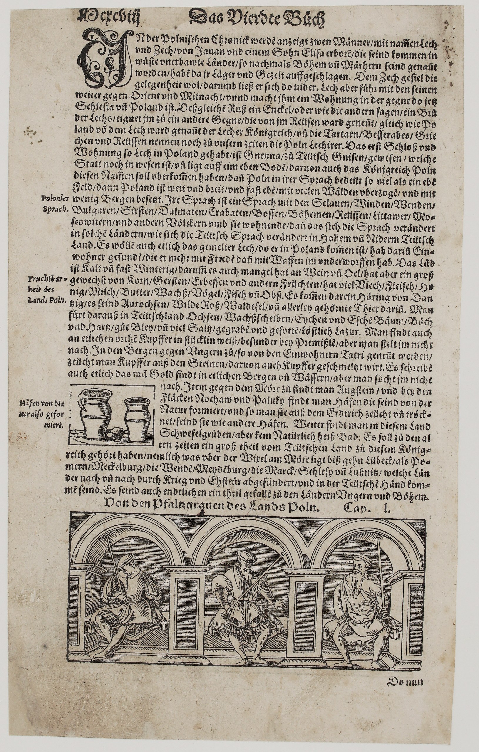
On verso, Münster continues on Poland:
- Origins: the legend of Lech and Czech, with Gniezno as the first seat of Lech.
- The country: the Polish language and its Slavic relatives; the land’s grain, honey, wax, cattle, aurochs and wild horses; salt, lead and copper; amber from the Baltic coast.
- A curiosity: the “natural pots” found in the ground near Nochów and Paluki, illustrated with a small woodcut.
- Chapter 50, Von den Pfaltzgrauen des Lands Poln: on the Palatines of Poland, with a woodcut of three Polish palatines seated in an arcade.
Cartographer: Sebastian Munster (1488 – 1552)
Publisher: Henricpetri press, Basel
Leaf size: 30,5 x 18,5 cm
Year: 1578 – 1588
Technique: Woodcut, with letterpress text
Reference: A. Muzikevičius, Lietuva Sebastiano Münsterio „Kosmografijoje“ 1544–1628
Condition:
Good. The woodcut is dark and strongly printed. There is light even toning and a few small spots, with slight wear at the edges. The margins are complete.
This is a genuine antique map published between 1578 – 1588 and not a modern copy or reprint
On your request I will provide a Certificate of Authenticity
In stock