- You cannot add that amount to the cart — we have 1 in stock and you already have 1 in your cart. View cart
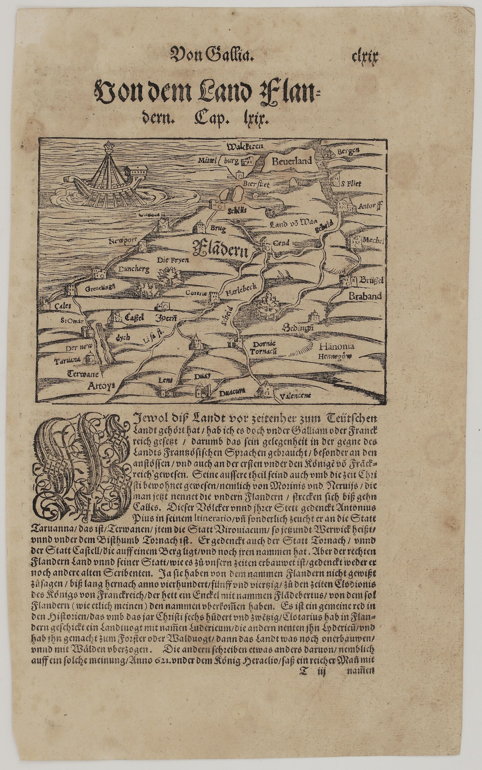
1578-1588 – S. Munster – Von dem Land Flandern
150 €
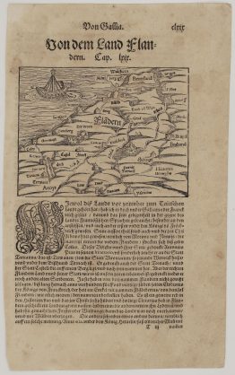
Title: Von dem Land Flandern
(Of the Land of Flanders)
Description:
This is one of the earliest printed maps of the County of Flanders, Belgium. Sebastian Münster first included it in his Cosmographia of 1550. This is the UNKNOWN issue of Sebastian Münster’s Cosmographey.
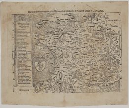
The map, titled “Fladern” in large letters, is drawn as a bird’s-eye view with the North Sea and a great sailing ship at upper left. It covers:
- the coast: Calais (“Cales”), Gravelines (“Greuelingn”), Dunkirk (“Dunckerg”), Nieuwpoort (“Newport”), Sluis (“Schlus”) and Biervliet, with Walcheren, Middelburg and Beveland in Zeeland;
- inland Flanders: Bruges (“Brug”), Ghent (“Gend”), the “Land vó Waas”, Kortrijk (“Cortric”), Harelbeke, Ypres (“Ypern”), Cassel and Saint-Omer, with the Scheldt (“Scheld”) and Lys (“Lis fl.”) rivers;
- to the east and south: Antwerp (“Antorff”), Mechelen, Brussels in Brabant, Bergen op Zoom, Enghien (“Edingen”), Hainaut (“Hanonia, Hennegöw”), Tournai (“Dornic, Tornacu”), Valenciennes, Douai, Lens, Thérouanne (“Terwane”) and Artois (“Artoys”).
The German text explains why Münster placed Flanders under France (“Gallia”) although it once belonged to Germany: the people spoke French. It covers:
- the Morini and the Nervii, and Antoninus Pius’s mention of Thérouanne, Wervik and Tournai;
- the legend that Flanders took its name from “Flandebertus”, grandson of the Frankish King Clodio, around 445;
- the forester Lyderic, appointed by King Clothar around 620.
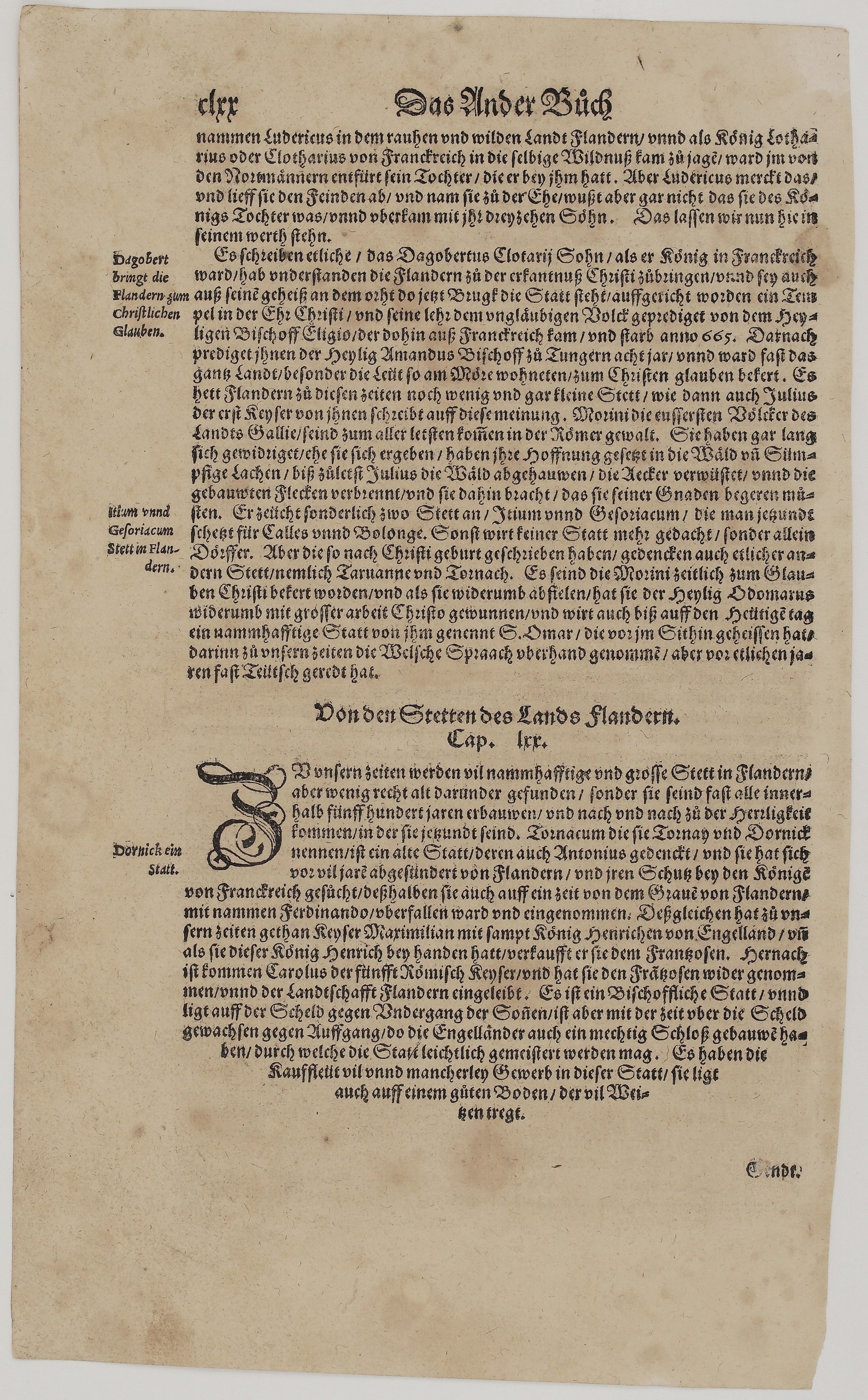
On the other side the chapter tells how Lyderic rescued King Clothar’s daughter from the Normans and married her, and how Dagobert, St Eligius and St Amand brought Christianity to Flanders. It notes that the ancient towns of Itium and Gesoriacum are taken to be Calais and Boulogne, and mentions St Omer. Cap. LXX, “Von den Stetten des Lands Flandern”, then describes Tournai (“Dornick”): it was sold to the French by Emperor Maximilian and Henry VIII, recovered by Charles V, and fortified by the English with a mighty castle.
Cartographer: Sebastian Munster (1488 – 1552)
Publisher: Henricpetri press, Basel
Leaf size: 33,1 x 20,2 cm
Year: 1578 – 1588
Technique: Woodcut, with letterpress text
Condition:
Good. Strong, dark impression with full margins. The paper is lightly toned, with light marginal soiling and a few small spots. There is minor edge wear and some show-through of the text.
This is a genuine antique map published between 1578 – 1588 and not a modern copy or reprint
On your request I will provide a Certificate of Authenticity
In stock