1621 – P. Bertius – Polonia
300 €
Title: “Polonia”
Description:
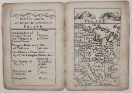
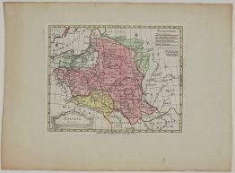
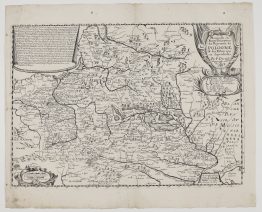
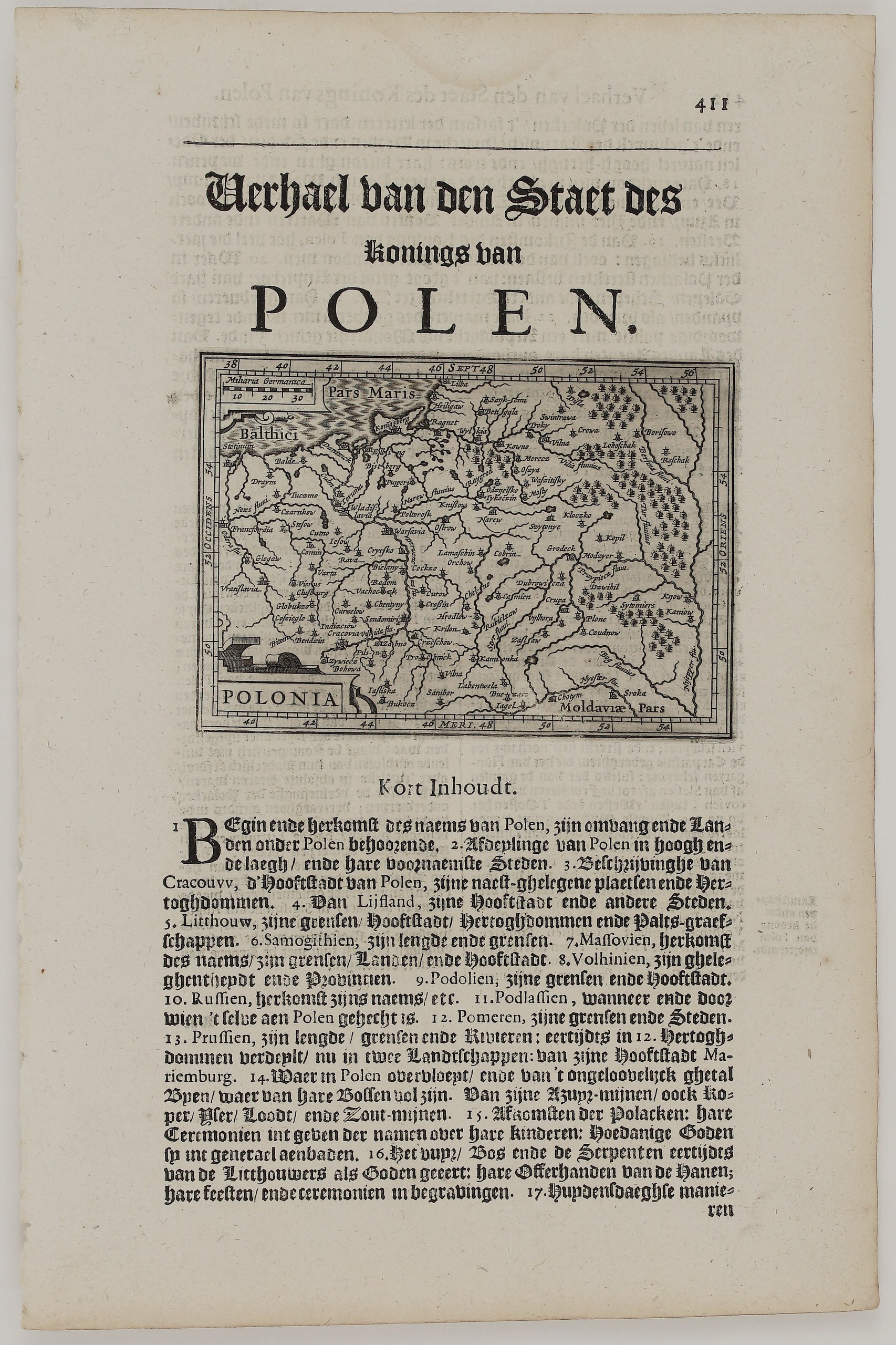
A small map of Poland and the Grand Duchy of Lithuania, rare edition, printed in the text of the Dutch Wereld spiegel (World Mirror), published in Amsterdam in 1621 by Jan Evertsz Cloppenburgh. The book is a Dutch translation by G. van der Eembd of Pierre d’Avity’s Les Estats, Empires et Principautez du Monde, a description of all the states of the world. Cloppenburgh illustrated it with the copper plates of Petrus Bertius’s pocket atlas. The map stands below the chapter heading “Verhael van den Staet des Konings van Polen” (Account of the State of the King of Poland), on page 411.
The map covers the Commonwealth from Frankfurt on the Oder and Silesia to Kyiv and the Dnieper, and from the Baltic to Moldavia. In Lithuania it names Vilnius (“Vilna”), Trakai (“Troky”), Kaunas (“Kowno”), Betygala (“Betigola”), Ragnit, Tykocin and Raygród, with the rivers Neris and Berezina. The vast forests of the east are drawn as clusters of trees. A scale of German miles sits in the upper left, and the title “Polonia” in a small cartouche in the lower left.
Below the map, the chapter’s “Kort Inhoudt” (short summary) lists the subjects that follow:
- Kraków, Livonia, Lithuania with its duchies and palatinates, Samogitia, Masovia, Volhynia, Podolia, Podlasie, Pomerania and Prussia.
- Poland’s riches, among them “the incredible number of bees of which its forests are full”, and its mines of azurite, copper, iron, lead and salt.
- The old religion of the Lithuanians, who once honoured fire, the forest and serpents as gods, sacrificed cockerels, and held feasts and funeral ceremonies.
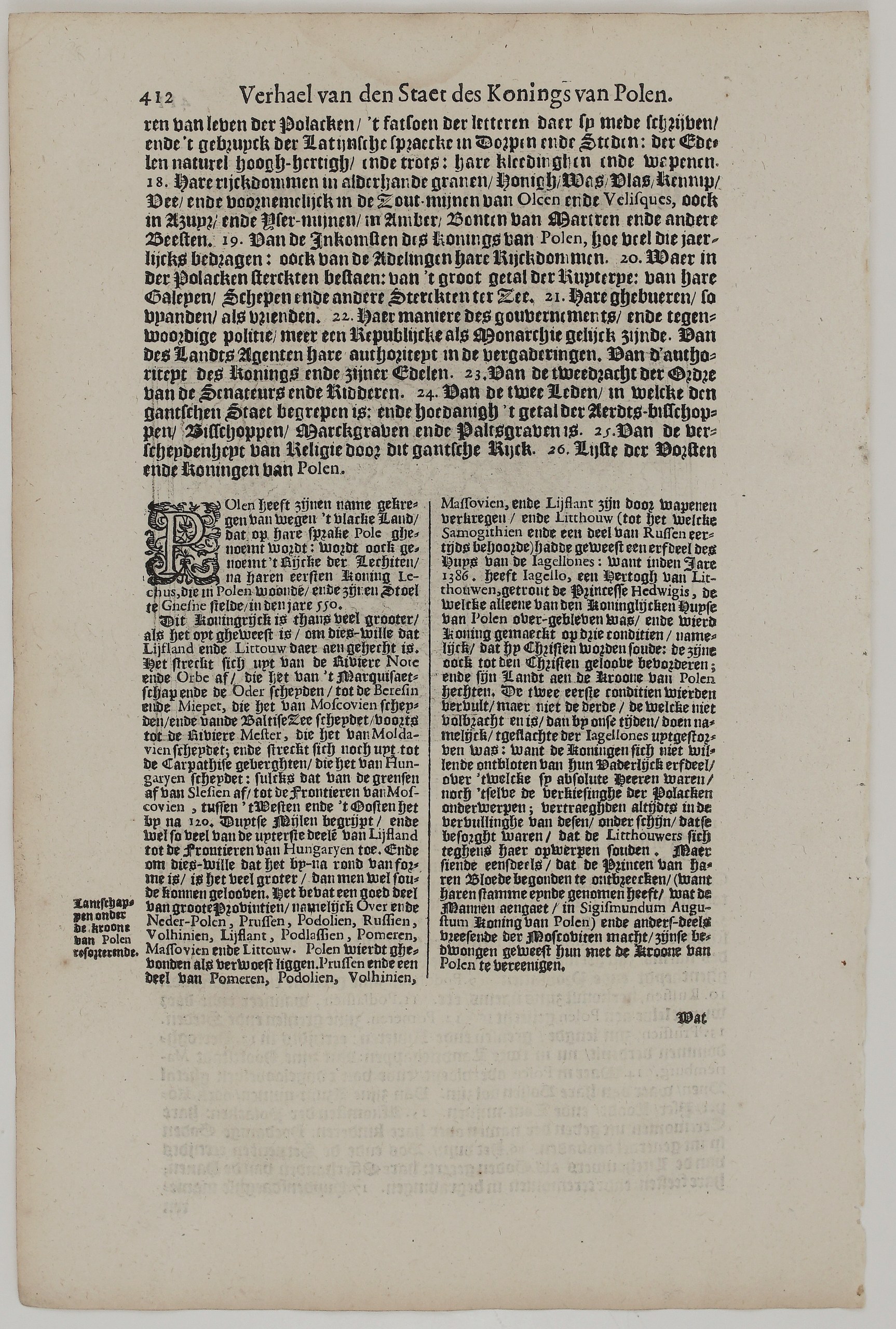
On the back (page 412) the summary continues with the riches of grain, honey, wax, amber and marten furs, the salt mines of Olkusz and Wieliczka, and a government “more like a republic than a monarchy”. The chapter then begins:
- The name: Poland takes its name from its flat land, “Pole” in the Polish language. It was also called the realm of the Lechites, after its first king Lechus, who set his throne at Gniezno.
- The union with Lithuania: In 1386 Jogaila, Duke of Lithuania, married Princess Jadwiga and became king, on condition that he become a Christian, spread the faith and join his land to the Crown. The last condition was fulfilled only “in our times”, after the Jagiellonian male line died out with Sigismund Augustus and the Lithuanians, fearing the power of Muscovy, united with the Crown of Poland.
Petrus Bertius (1565–1629) was a Flemish scholar and geographer in Leiden. His pocket atlas grew out of Barent Langenes’s Caert-Thresoor of 1598, whose maps were engraved in the Hondius workshop.
Cartographer: Petrus Bertius (1565 – 1629)
Publisher: Jan Evertsz Cloppenburgh, Amsterdam
Sheet size: 32.0 x 21.0 cm
Year: 1621
Technique: copper engraving
Condition:
Good. Uncoloured, with a strong impression. Light show-through of the text on the back. Clean, wide margins. Watermarked paper.
This is an original antique map published in 1621 and NOT a modern copy or reprint
On your request I will provide a Certificate of Authenticity
In stock