1626 – J. Speed – A Newe Mape of Germany
800 €
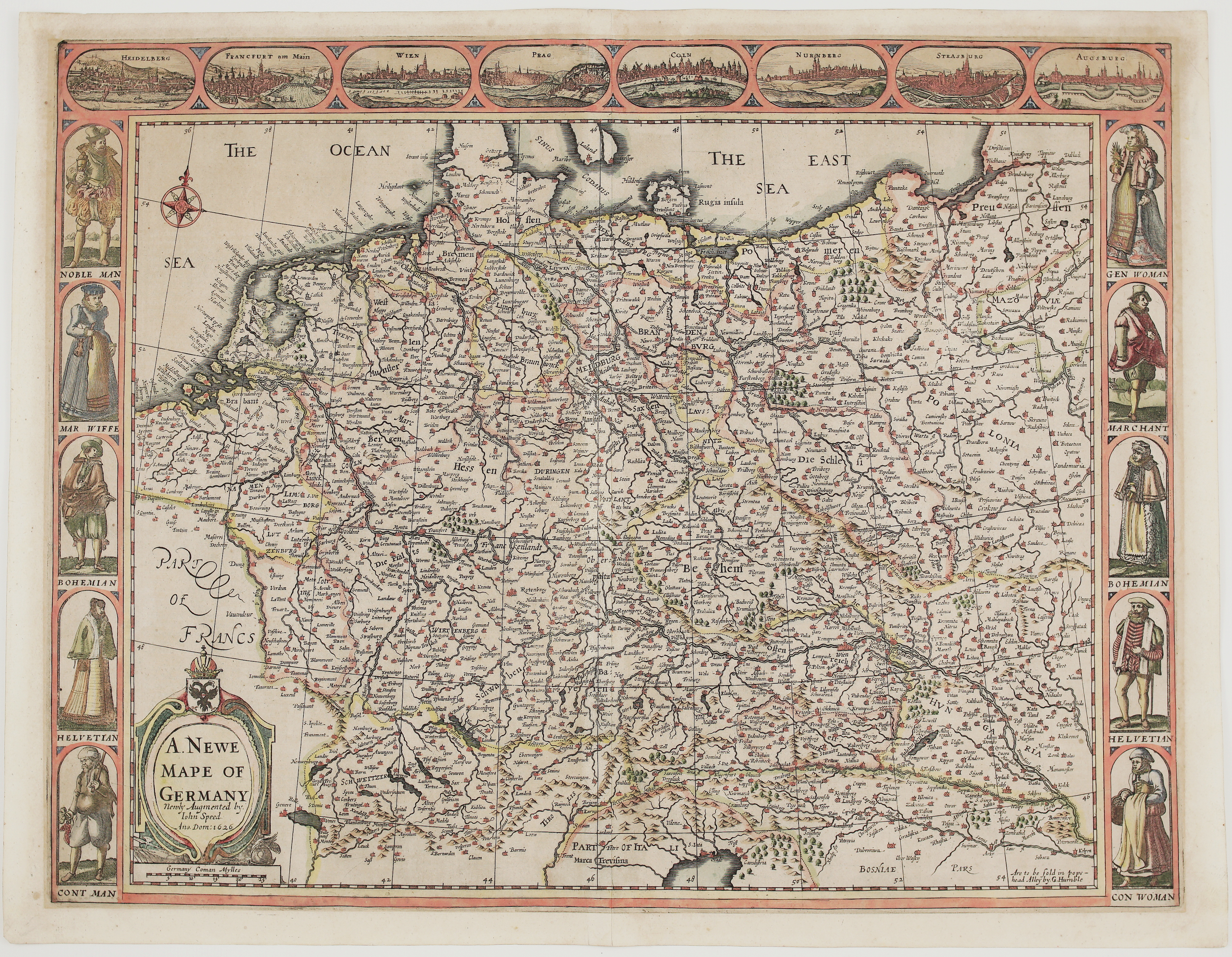
Title: “A. Newe Mape of Germany Newly Augmented by. Iohn Speed. Ano. Dom: 1626”
Description:
A decorative carte-à-figures map of Germany and Central Europe from John Speed’s “A Prospect of the Most Famous Parts of the World”, the first world atlas compiled by an Englishman. George Humble first published it in London in 1627, and its maps are dated 1626. This map carries Humble’s imprint, “Are to be sold in pops-head Alley by G. Humble”, which was used on the editions before the Bassett & Chiswell issue of 1676.
The map shows the Holy Roman Empire in the years of the Thirty Years’ War. It reaches from the Low Countries, Lorraine and Switzerland in the west to Prussia, Poland and Hungary in the east, and from Holstein and “The East Sea” (the Baltic) south to northern Italy and Bosnia. It is densely filled with towns, rivers, forests and mountains, and has a compass rose in “The Ocean Sea”. The title cartouche, topped by the crowned double-headed imperial eagle.
The decorative border is what makes Speed’s maps so sought after. Eight oval bird’s-eye views run along the top: Heidelberg, Frankfurt am Main, Vienna, Prague, Cologne, Nuremberg, Strasbourg and Augsburg. The side panels show ten figures in German costume: a nobleman and a gentlewoman, a merchant and his wife, Bohemian and Swiss men and women, and a countryman and a countrywoman.
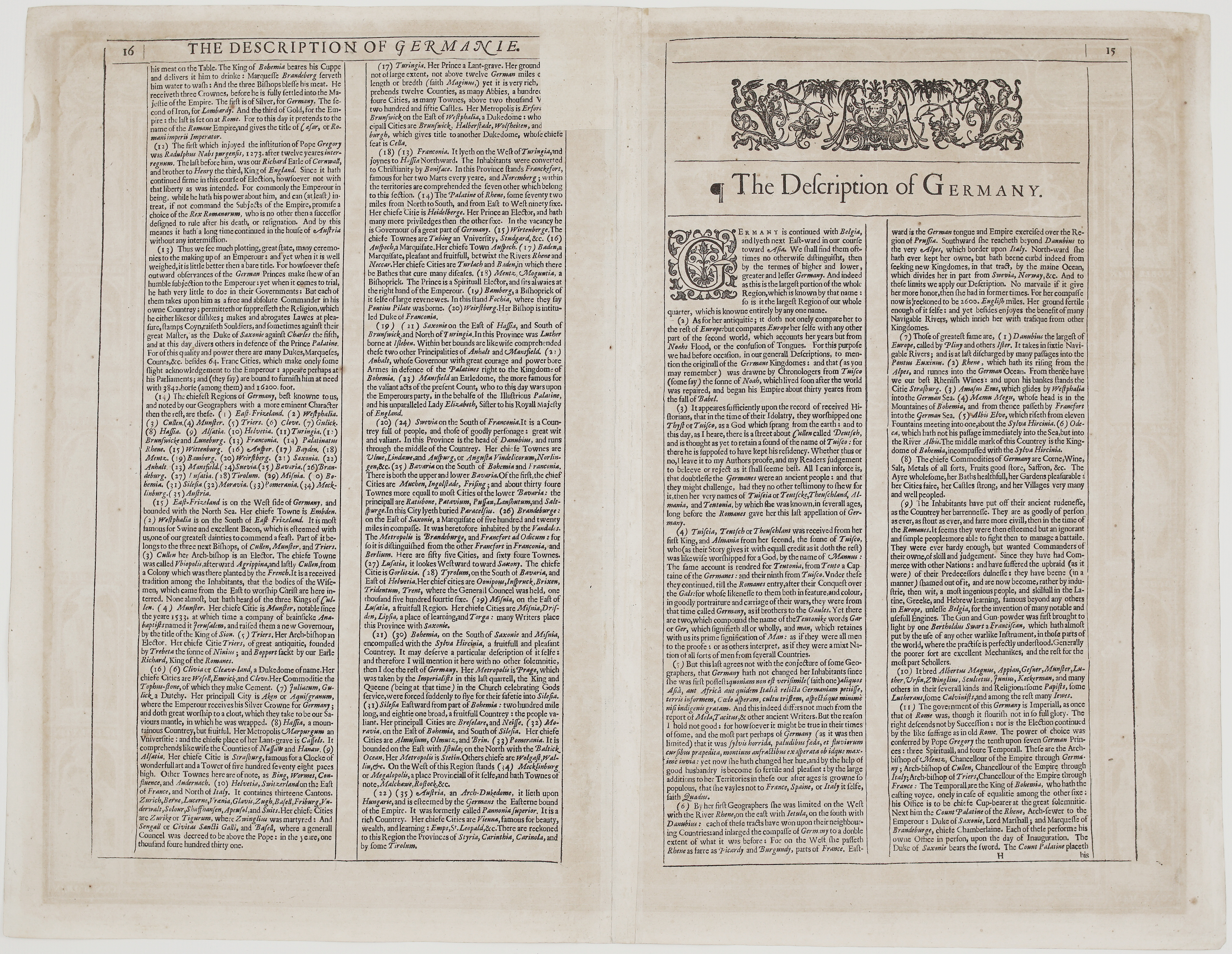
Verso. The back carries English text, “The Description of Germany”, with a woodcut headpiece and a decorative initial. Speed explains the name “Germany” and its legendary founder Tuisco, the rivers and products of the land, and credits the invention of gunpowder to “Bertholdus Swart a Franciscan”. He describes the government of the Empire, the seven Electors and their duties at the coronation, and the Emperor’s three crowns of silver, iron and gold. He then surveys 35 provinces, from Westphalia, “famous for Swine and excellent Bacon”, and Münster with its Anabaptist “King of Sion”, to Bohemia, Silesia, Pomerania and Austria.
The text was written during the Thirty Years’ War. It recalls the fall of Prague, when the King and Queen of Bohemia (Frederick V and Elizabeth Stuart, the “Winter King” and “Winter Queen”) had to flee to Silesia. It also praises Count Mansfeld, “who to this day wars upon the Emperours party, in the behalfe of the Illustrious Palatine, and his unparalleled Lady Elizabeth, Sister to his Royall Majesty of England”.
This is one of the most decorative 17th-century maps of Germany, by Britain’s best-known early mapmaker.
Cartographer: John Speed (1551 – 1629)
Publisher: George Humble
Sheet size: 56,5 x 43,8 cm
Year: 1626
Technique: copper engraving
Condition:
Good condition. Strong impression on watermarked paper; narrow upper margin and wide lower margin; centrefold as issued. Light toning and minor spotting, mainly in the margins and on the verso.
This is an original antique map published in 1626 and NOT a modern copy or reprint
On your request I will provide a Certificate of Authenticity
In stock