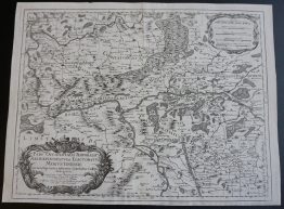
1730 – M. Seutter – Silesiae Ducatus
220 €
Title: “Silesiae Ducatus tam Superior quam Inferior juxta suos XVII minores Principatus et VI Libera Dominia disterminat. nova Mappa Geographica…”
Description:
Detailed map of the ancient region of Silesia, now located in Western Poland, including figure title-cartouche and an inset plan of the city of Wroclaw (Breslau) with a coat of arms.
Comes from Matthaus Seutter atlas “Grosser Atlas” published in Augsburg 1730.
Cartographer: Matthaus Seutter (1678-1757)
Sheet size: 58,0 x 50,3 cm
Year: 1730
Technique: copper engraving
Condition:
Good condition. Contemporary hand coloring on watermarked paper. Narrow margins. Middle fold as published and horizontal bending line present.
This is an original antique map published in 1730 and NOT a modern copy or reprint
On your request we will provide a Certificate of Authenticity.
In stock