1793 – Covens & Mortier – Carte Generale de la Pologne
2,400 €
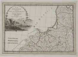
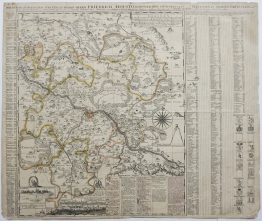
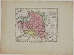
Title: “Carte Generale & Itineraire de la Pologne avec les Païs qui y apartenoient ci-devant. A Amsterdam chez Covens & Mortier, & Covens Junior. 1781.”
(General and itinerary map of Poland, with the lands that formerly belonged to it)
Description:
A rare map of the Polish-Lithuanian Commonwealth that shows how it was carved up in the partitions. The plate was first published in Amsterdam in 1781. This is the second state, issued around 1793 after the Second Partition. It has a separately printed colour key, in the form of a scroll, pasted on at the upper right. The key explains the colouring:
- A, B and C: the lands given to the King of Prussia, the Empress of Russia and the Emperor of Germany in the First Partition, dated 1774 on the key.
- D and E: the lands taken by Prussia and Russia in the Second Partition of 1793.
- F: “Le Royaume de Pologne comme il est à présent”, the Kingdom of Poland as it now is.
The surviving state is washed in pink. It is a narrow band running from Samogitia, Kaunas and Vilnius in the north, through Grodno, Warsaw and Lublin, down to Kraków. All around it lie the lost lands: Greater Poland, Danzig and Toruń to the west; Minsk, Polotsk, Volhynia and Podolia to the east; and Galicia to the south. Barely two years later the Third Partition of 1795 removed the Commonwealth from the map altogether.
As an itinerary map, it marks the main roads across the country, and a key in the upper right explains the symbols for towns, villages and the seats of archbishops and bishops. Below the map are five scale bars for Polish, Lithuanian and Ukrainian miles, measured in the ells of Warsaw and Vilnius.
The Rococo title cartouche shows a putto with a trumpet holding the monogram “SAR”, for Stanislaus Augustus Rex, beside the crowned arms of the Commonwealth. The arms combine the White Eagle of Poland and the Vytis of Lithuania, with the bull of the Ciołek arms of King Stanisław August Poniatowski at the centre.
The map was engraved by Jan van Jagen and published by Covens & Mortier, the Amsterdam firm that continued the business of Pieter Mortier. Barry Ruderman, who sold a copy of this state, wrote that he had never seen the map on the market before.
Cartographer/Publisher: J. Covens & P. Mortier & C. Covens Jr. (1721-1866)
Engraver: Jan van Jagen
Sheet size: 67,2 x 56,8 cm
Year: c. 1793 (second state; plate dated 1781), Amsterdam
Technique: copper engraving
Reference: Imago Poloniae, K 67
Condition:
Very good condition, contemporary hand coloring. Paper with original watermarks. Wide margins.
This is an original antique map published in 1793 and NOT a modern copy or reprint
On your request I will provide a Certificate of Authenticity
In stock