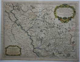
1788 – F. A. Schraembl – Generalkarte von Polen Litauen
1 312,00 zł
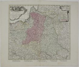
Title: “Generalkarte von Polen, Litauen, und den angraenzenden Laendern Nach Zannoni, Folin, Uz, Pfau etc. etc. Neu herausgegeben von F. A. Schraembl. MDCCLXXXVIII. ”
Description:
Rare and very detailed map of Lithuania, Latvia and Belarus, after Bartolomeo de Folino map published in 1770. The map is centered on Minsk, Polock region, including Vilnius and Trakai region.
The map comes from Franz Anton Schraembl atlas “Allgemeiner Grosser Atlas- hrgb. von Franz Anton Schraembl…” engraved by Heronimus Benedicti, published in Viena, 1788.
Cartographers:
Franz Anton Schraembl (1751-1803)
Giovanni Antonio Rizzi Zannoni (1736–1814)
Georg Friedrich Uz (1742-1793)
Theodor Pfau (1725–1794)
Bartolomeo de Folino (1730–1808)
Sheet size: 83,5 x 60,5 cm
Year: 1788
Technique: copper engraving
Condition:
Very good condition. Strong press on watermarked paper.
This is an original antique map published in 1788 and not a modern copy or reprint
On your request I will provide a Certificate of Authenticity
In stock