1600 – M. Quad – Poloniae
450 €
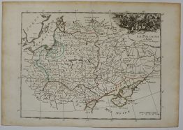
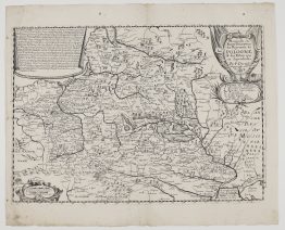
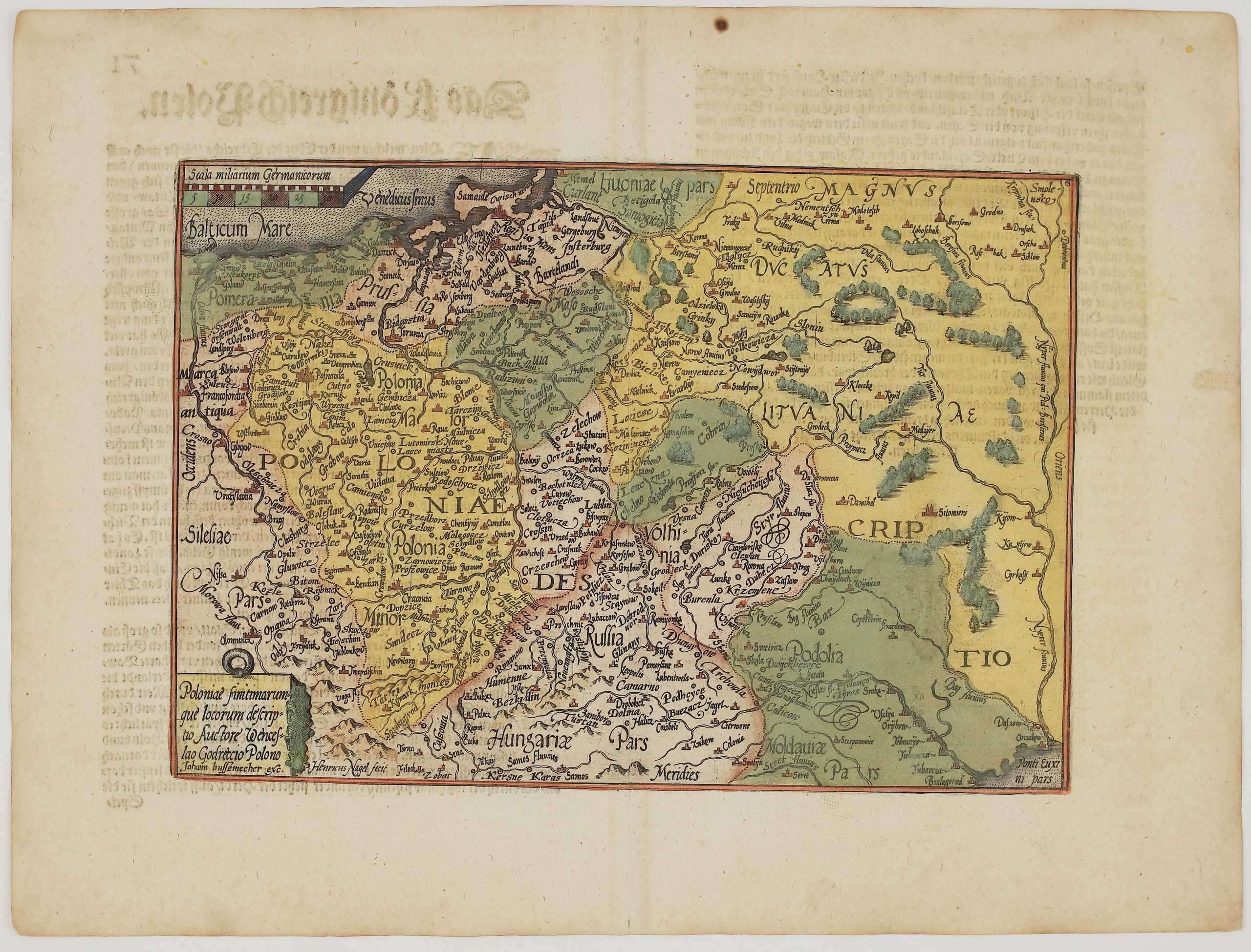
Title: “Poloniae finitimarumque locorum descriptio. Auctore Wenceslao Godreccio Polono. Johann Bussemecher exc.”
(A description of Poland and the neighbouring lands, by the Pole Wacław Grodecki. Published by Johann Bussemacher)
Description:
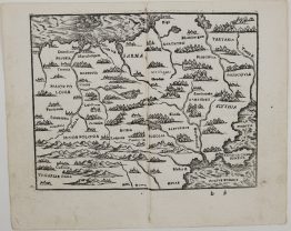
A finely engraved small Quad map of Poland and the Grand Duchy of Lithuania, published in Cologne by Matthias Quad and Johann Bussemacher. It is a reduced version of Wacław Grodecki’s map of Poland, the first map of the country by a Polish cartographer, which Abraham Ortelius had adopted for his Theatrum Orbis Terrarum. Quad’s pocket atlases were cheaper alternatives to Ortelius’s large folio atlas. This example comes from the Geographisch Handtbuch of 1600, the first atlas originally written with German text.
The map shows the Polish-Lithuanian Commonwealth from Pomerania and Silesia in the west to Smolensk, Kyiv and the Black Sea in the east, with each region in its own colour:
- Lithuania: “Magnus Ducatus Lituaniae” fills the upper right. It names Vilnius (“Vilna”), Trakai (“Troky”), Medininkai, Nemenčinė, Rūdninkai, Grodno, Slonim, Navahrudak region towns, Pinsk, Kobryn, Kapyl, Babruysk’s neighbours on the Berezina and Borisov. The great forests of the Grand Duchy are drawn as clusters of trees, between the rivers Neris (“Vilia”), Berezina, Pripyat and Dnieper.
- Samogitia and Livonia: Samogitia with Betygala (“Betigola”), Courland (“Curlant”) and part of Livonia.
- Poland: Greater and Lesser Poland, Masovia, Kraków and the Tatra Mountains.
- The east and south: Red Ruthenia with Lviv, Volhynia, Podolia, Moldavia and part of Hungary.
- The north: Royal and Ducal Prussia with Danzig and Königsberg, on the “Venedicus sinus” of the Baltic Sea.
The title cartouche is in the lower left, and a scale of German miles in the upper left. The map is signed by the engraver “Henricus Nagel fecit”.
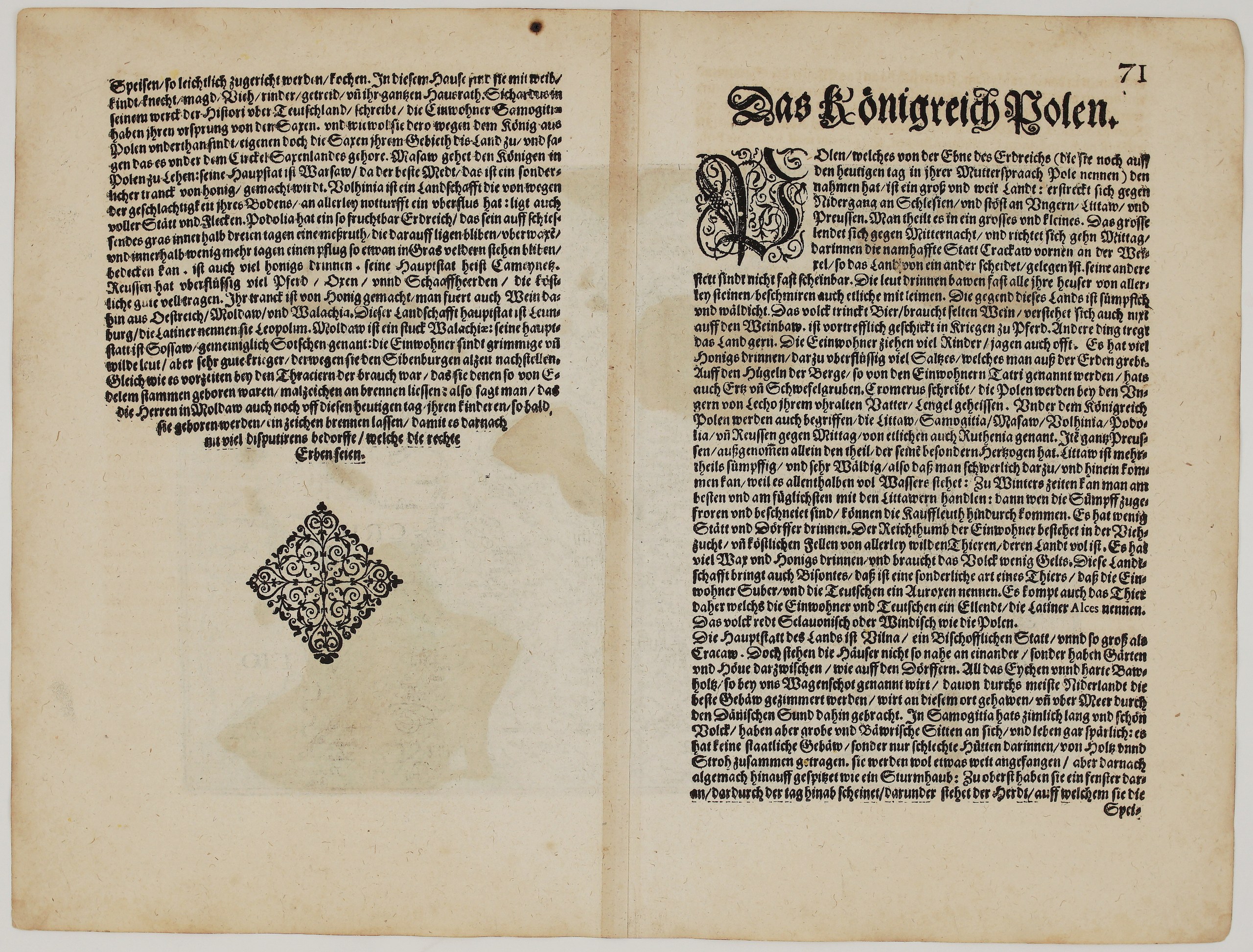
On the back is Quad’s German description, “Das Königreich Polen” (page 71), which is full of lively detail:
- Poland: the Poles build their houses of wood daubed with clay, drink beer and rarely wine, and are excellent horsemen in war. Salt is dug out of the earth.
- Lithuania: the country is so full of marshes and forests that merchants can only travel there in winter, when the marshes freeze. Its wealth is in cattle, furs, wax and honey, and in its bison, “which the inhabitants call Zubr”. Vilnius is a bishop’s city “as large as Kraków”, with gardens between the houses. The oak cut there is shipped through the Danish Sound to build the finest houses in the Netherlands.
- Samogitia: the people are tall and handsome but live in huts of wood and straw shaped like a helmet, with a window at the top above the hearth.
- The south: the best mead is made in Warsaw. Podolia is so fertile that a measuring rod left in the grass is overgrown within three days.
Cartographers: Matthias Quad (1557–1613), after Wacław Grodecki
Publisher: Johann Bussemacher, Cologne
Engraver: Henricus Nagel
Sheet size: 36,3 x 27,3 cm
Year: 1600
Technique: copper engraving
Reference: Imago Poloniae, K 7/7
Condition:
Good. Attractive hand colour. Some show-through of the text on the back. Light dampstain, mainly visible on the verso. A small hole in the upper margin, outside the map. Centrefold as issued. Watermarked paper.
This is an original antique map published in 1600 and NOT a modern copy or reprint
On your request I will provide a Certificate of Authenticity
In stock