

1691 – V. M. Coronelli – America Meridionale
1,500 €
Titles: “America Meridionale. Auttore il P. M. Coronelli M. C., Cosmografo della Serenissima Repub. di Venetia. Dedicata all’Ill. et Ecc. Sig. il Sign. Pietro Foscarini”
(South America, by Father Coronelli, Minorite, Cosmographer of the Most Serene Republic of Venice, dedicated to the Most Illustrious and Excellent Lord Pietro Foscarini)
Description:
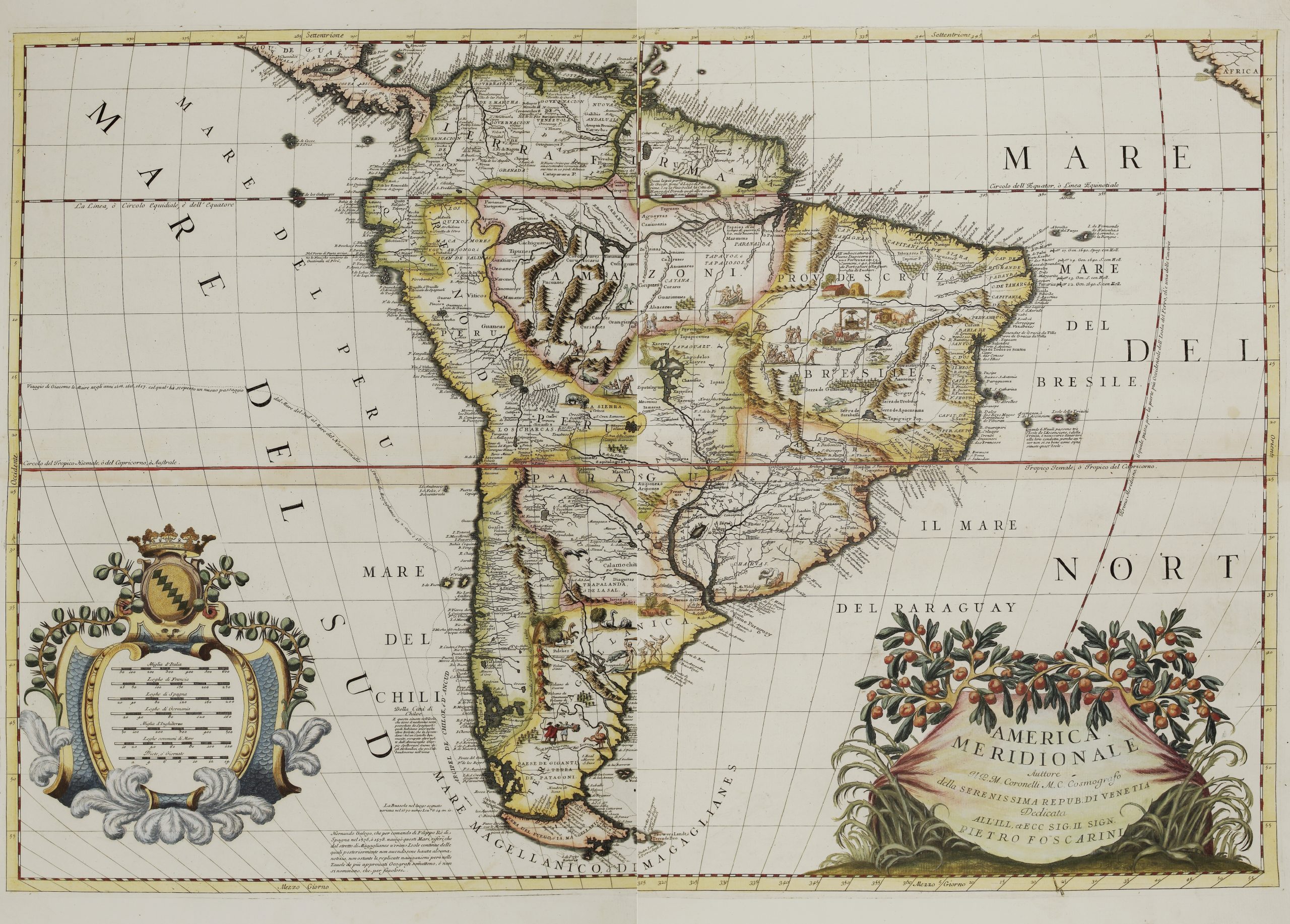
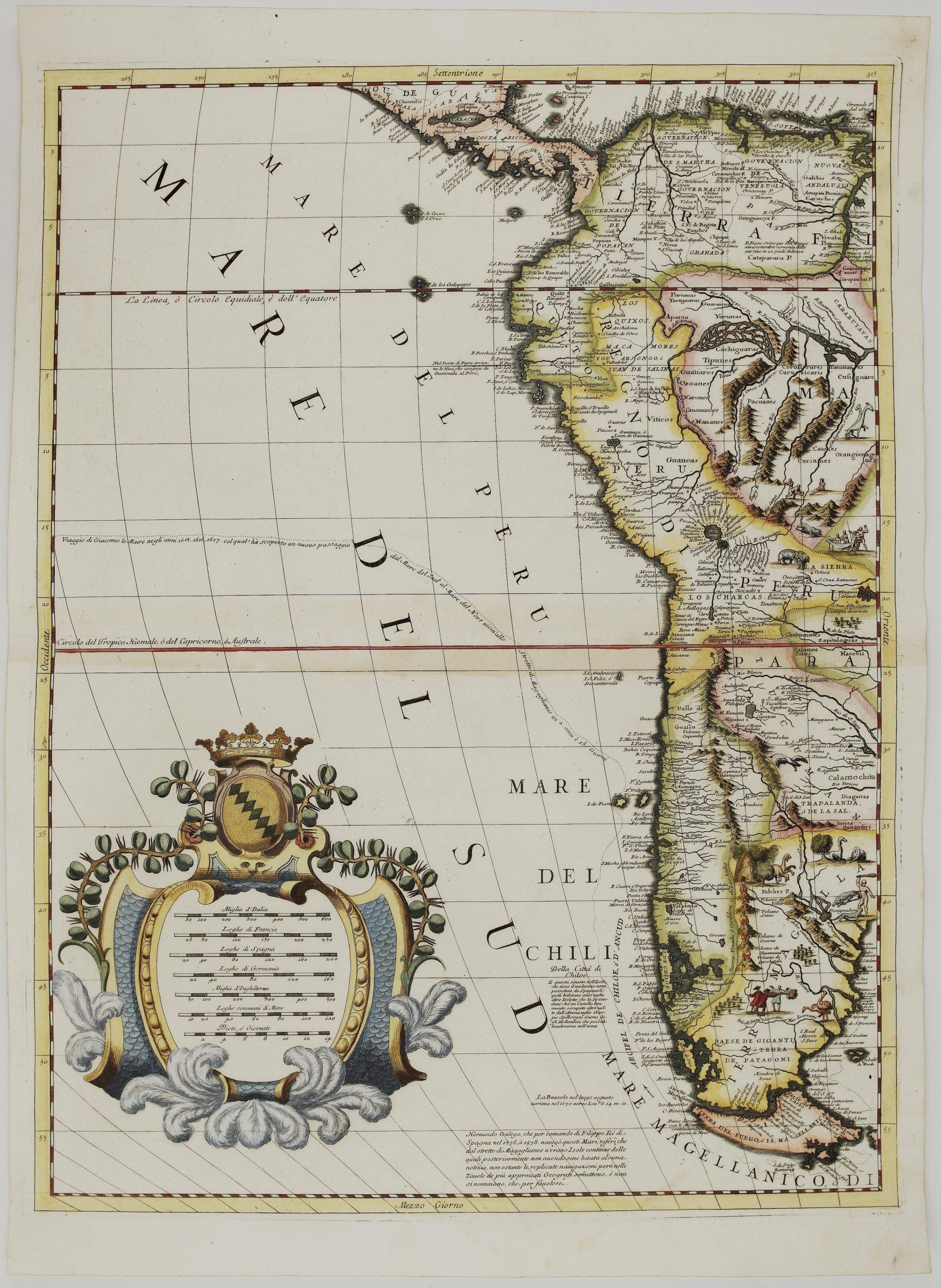
A large and spectacular map of South America by Vincenzo Maria Coronelli, printed on two separate sheets. Joined, they measure almost 90 cm across. The map was published in Venice in 1691 in Coronelli’s Atlante Veneto, his great atlas intended to rival Joan Blaeu’s Atlas Maior. As official cosmographer of the Venetian Republic, Coronelli drew on Spanish and French reports and on the accounts of the great voyages.
The continent is filled with detail and with small scenes of its peoples and animals:
- Brazil: divided into its Portuguese captaincies, with dozens of names along the coast. Inland are scenes of farming, hunting and cannibalism.
- The legends: Lake Parime, the lake of El Dorado, appears on the equator with a note doubting its existence. The Río de la Plata flows from the great Lake of the Xarayes.
- The Andes: drawn as a chain of mountain vignettes along the Pacific coast, with Lake Titicaca and Potosí. Llamas, rheas, jaguars and imaginary animals fill the interior.
- Patagonia: labelled “Paese de Giganti, Terra de Patagoni”, the land of the giants first reported by Magellan’s crew.
- The far south: the route of Jacob Le Maire’s voyage of 1615–1617 is traced around Cape Horn, “by which he discovered a new passage from the North Sea to the South Sea”. A note records the voyages of Hernando Gallego for Philip II in 1576 and 1578.
- The seas: the oceans are named in Italian, “Mare del Nort”, “Mare del Sud”, “Mare del Bresile” and “Il Mare del Paraguay”. On the right, a dashed line marks the prime meridian through the Isle of Ferro in the Canaries.
The two cartouches are among Coronelli’s finest:
- Title cartouche (lower right): the title is set on a shell-shaped drape beneath a branch heavy with fruit and tall grasses.
- Scale cartouche (lower left): a crowned coat of arms, presumably that of the dedicatee, Pietro Foscarini, tops a frame with seven scales. They show Italian miles, French, Spanish and German leagues, English miles, common sea leagues and days’ travel.
Vincenzo Maria Coronelli (1650–1718) was a Franciscan friar and one of the great mapmakers of the Baroque. He made the celebrated giant globes for Louis XIV and founded the Accademia degli Argonauti, the first geographical society.
Cartographer: Vincenzo Maria Coronelli (1650-1718)
Sheet size: two sheets, each measure 48,0 x 66,4 cm
Year: 1691
Technique: copper engraving
Reference: Shirley, Maps in the Atlases of the British Library, T.CORO-7a, nos. 14–15
Condition:
Very good condition. Beautiful hand coloring. Watermarked paper.
This is an original antique map published in 1691 and NOT a modern copy or reprint
On your request I will provide a Certificate of Authenticity
In stock