1732 – J. B. Homann – Ducatus Saxoniae
150 €
Title: “Ducatus Saxoniae Superioris: prout fuit ipsius human ab anno 1000 usque ad A. 1400 sive intra Seculum XM et XVm ex historia Maxim media designatus aetatis erudtus ac Geographice. by Frid. Zollmann. A.C. S U. S. in lucem Pro Latus from Homann Heredib. Norib. A. 1732 cum Privil Tab. II.”
Description:
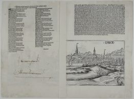
Highly decorative and detailed map of area from Görlitz and Lausitz in the east to Thuringia in the west, Germany. This publication is one of the earliest independent maps of the Thuringian-Saxon area to be published. At the top the coats of arms of Palatinate Saxony, Marck Landsb., Bgr Magdeburg, Gr. Orlamunde, Gr. Pleissen, Bgr. Altenburg, Cathedral Coldiz, Bgr. Donin, Gr. Arnshau, Gr. Wolckenst. , Brg. Meissen, Gr Brene, Brg Zörbig, Br. Rochlitz, Brg. Leisnig, Eilenburg Cathedral, Plauen Cathedral, Gr. Wettin, Dom Strela, Brg Starckenb., Dom Dreisig, Gr. Weisenfels, Gr. Kefernburg, Dom. Torga and Gr. Groitsch. The lower part is decorated with a depiction of a Knight tournament in the City of Nordhausen in 1265.
The map was designed by Friedrich Zollmann and published by the Nuremberg publishing house Homann Erben in 1732.
Publisher: Johann Baptist Homann (1664-1724)
Sheet size: 51,5 x 61,0 cm
Year: 1732
Technique: copper engraving
Condition:
Good condition. Strong press and on watermarked paper.
This is an original antique map published in 1732 and NOT a modern copy or reprint
On your request I will provide a Certificate of Authenticity
In stock