1764 – G. N. Raspe – Stadt Prag
120 €
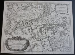
Title: “No. 6 Belagerung und Bloquade der Stadt Prag . im Jahre 1757”
Description:
Rare plan of the city of Prague, Czech Republic, with surroundings and schematic drawing of troop positions.
The engraving comes Raspe’s atlas ‘Schau Platz des gegenwaertigen Kriegs‘ published in Nürnberg 1764.
Cartographer: Gabriel Nikolaus Raspe (1712–1785)
Leaf size: 36.0 x 23.8 cm
Year: 1764
Technique: copper engraving
Condition:
Very good condition. Contemporary hand coloring.
This is an ORIGINAL antique map published in 1764 and NOT a modern copy or reprint
On your request I will provide a Certificate of Authenticity
In stock