1578-1588 – S. Munster – Africa mit seinen Ländern
300 €
Title: Africa mit seinen besondern Ländern, Thieren, und Wunderbarlichen dingen
(Africa with its particular Lands, Animals and Wondrous Things)
Description:
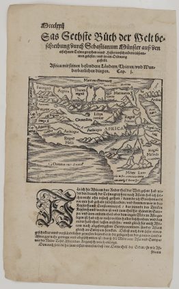
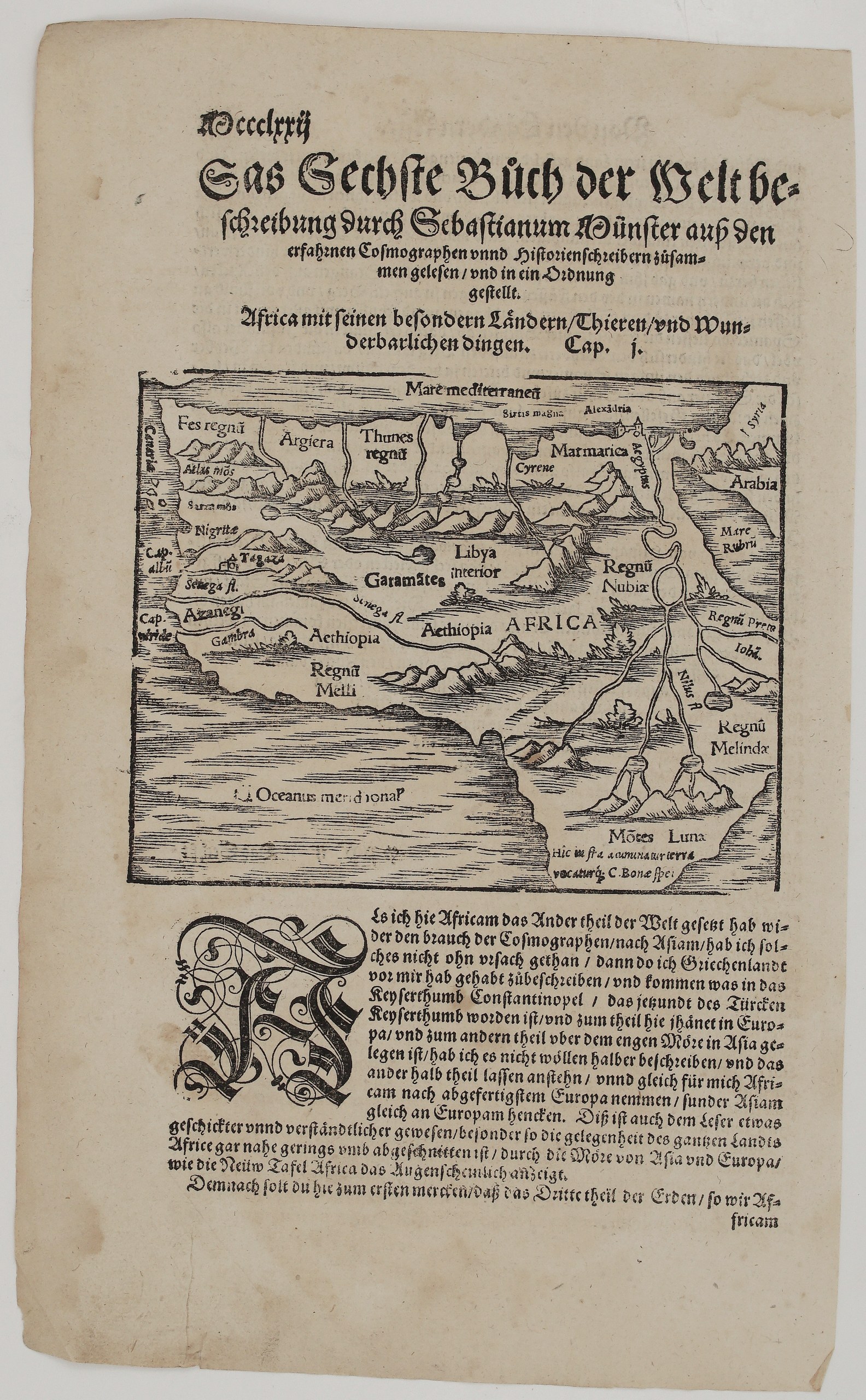
This is an original woodcut map of Africa from Sebastian Münster’s Cosmographey. It was printed in Basel by the Henricpetri press in between 1578 – 1588 and opens the sixth book, “Das Sechste Bůch der Weltbeschreibung”, which is devoted to Africa. Unknown issue of Sebastian Münster’s Cosmographey.
Münster’s little map shows Africa as Europeans pictured it in the 16th century:
- The North African coast: the kingdoms of Fez, Algiers (Argiera), Tunis, Marmarica and Cyrene, with Alexandria at the mouth of the Nile.
- The interior: Libya interior, the Garamantes, Nubia and Ethiopia, and the West African kingdom of Mali (Regnū Melli) beside the Senegal and Gambia rivers.
- The Nile: it flows from two great lakes beneath the legendary Mountains of the Moon (Montes Lunae), as Ptolemy described.
- The east and south: the kingdom of Prester John and Melinde (Malindi) in the east. At the bottom a note explains that the land narrows below to the Cape of Good Hope (“Hic infra acuminatur terra vocaturque C. Bonae spei”).
Münster’s text below explains why he describes Africa after Asia and begins with the continent’s peoples, animals and wonders.
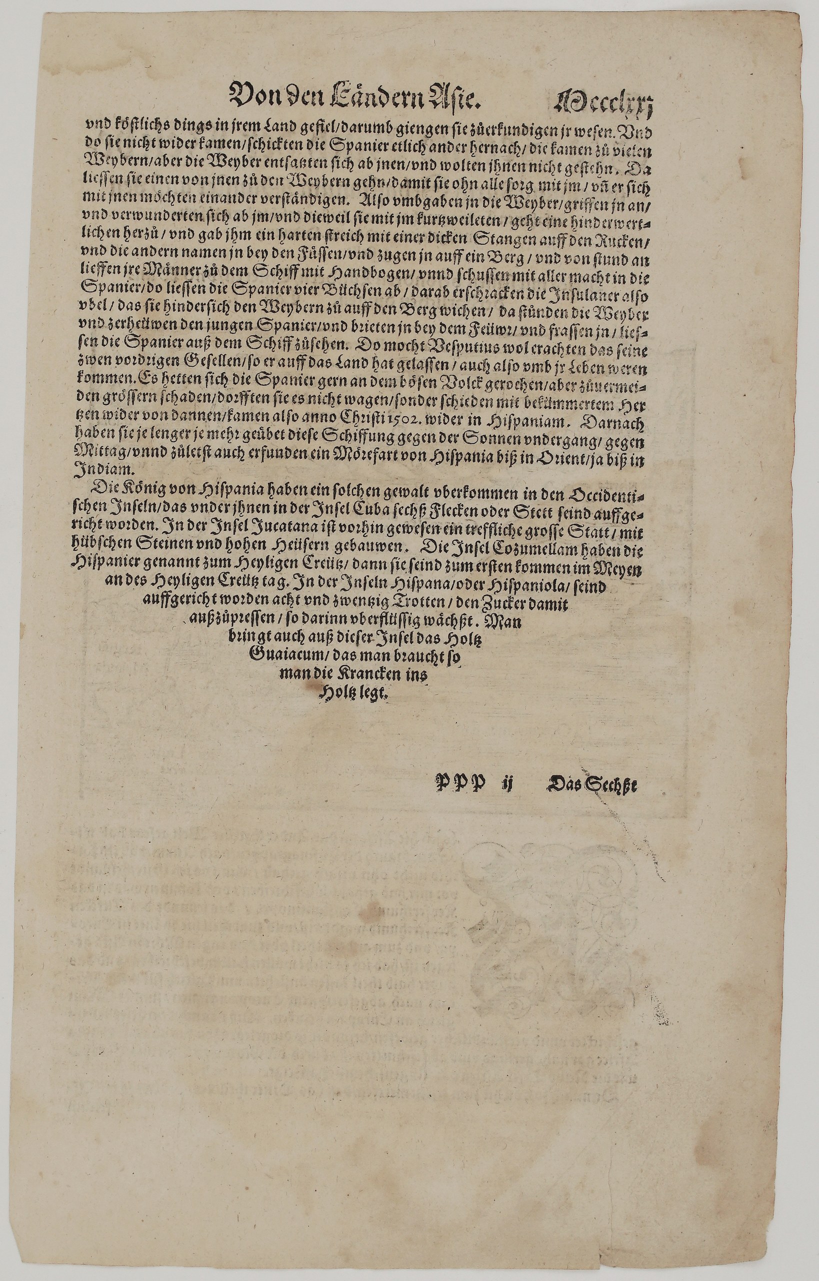
On the back is the end of Book 5, on the New World. It tells, from Amerigo Vespucci’s account, how a young Spaniard was killed and roasted by islanders, and how the Spaniards returned home in 1502. It goes on to the Spanish settlements in the West Indies: six towns on Cuba, the stone houses of Yucatán, Cozumel (named Santa Cruz), the 28 sugar mills of Hispaniola, and guaiacum wood, used to treat the sick.
Cartographer: Sebastian Munster (1488 – 1552)
Publisher: Henricpetri press, Basel
Leaf size: 33,3 x 20,3 cm
Year: 1578 – 1588
Technique: Woodcut, with letterpress text
Condition:
Good. The woodcut is dark and strongly printed. There is light even toning and a few small spots, with slight wear and short nicks at the edges. The margins are complete.
This is a genuine antique map published between 1578 – 1588 and not a modern copy or reprint
On your request I will provide a Certificate of Authenticity
In stock