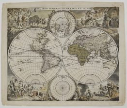
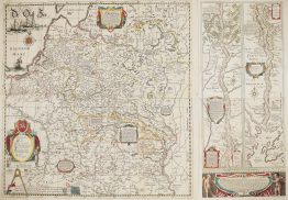
1685 – J. Danckerts – Nova Totius Terrarum Orbis Tabula
3,700 €
Title: “Nova Totius Terrarum Orbis Tabula. Amstelodami per I. Danckerts cum Privil.”
(A new map of the whole world, published in Amsterdam by J. Danckerts, with privilege)
Description:
A richly decorated Baroque double-hemisphere world map, published in Amsterdam by Justus Danckerts around 1685. Its decoration copies Frederick de Wit’s celebrated sea-atlas world map of 1668, whose allegorical surround was etched by Romeyn de Hooghe. This is the second and revised of Danckerts’ two world maps. It is a completely new engraving, made after the family received its publishing privilege in 1684, as the words “cum Privil.” in the title show.
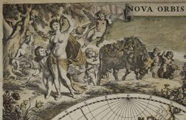
The hemispheres are surrounded by allegorical scenes of the four elements:
- Fire (upper left): a battle rages before a burning town, while Pluto carries off Proserpina.
- Air (upper right): Jupiter with his eagle and Juno with her peacocks sit enthroned on clouds among the gods, beneath an arch of the zodiac. A winged wind blows across the sky.
- Earth (lower left): goddesses of the earth sit with fruits and animals, before a landscape of harvest and husbandry.
- Water (lower right): Neptune with his trident rides among tritons and putti, while Dutch ships sail past and a whale sends up a tall spout.
Two polar projections sit above and below the hemispheres. On this second plate the southern projection was redrawn to reach the equator, showing the southern parts of South America, Africa and the East Indies.
The geography reflects the late 17th century:
- America: California is an island, and the mythical “Terra Esonis” stretches from the north-west coast of America towards Asia. The Great Lakes are open-ended, after Sanson.
- South America and Africa: a remnant of the legendary Lake Parime appears in South America. In Africa the Nile rises from twin lakes.
- The Pacific: New Guinea is drawn as an island on the western edge of the western hemisphere. Australia appears only as its northern and western coasts. Abel Tasman’s discoveries of 1642–43 appear as fragments of Van Diemen’s Land (Tasmania) and New Zealand.
Justus Danckerts (1635–1701) ran a publishing house in the Kalverstraat in Amsterdam. With his sons Theodorus and Cornelis, both trained engravers, he built up the family’s atlas business from the 1680s.
Cartographer: Justus Danckerts (1635-1701)
Sheet size: 50,5 x 60,1 cm
Year: 1685
Technique: copper engraving
Reference: Shirley, The Mapping of the World, no. 529
Condition:
Reasonable. Contemporary hand colour. A few tiny losses and splits professionally restored. Narrow margins.
This is an original antique map published in 1685 and NOT a modern copy or reprint
On your request we will provide a Certificate of Authenticity
In stock