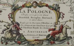
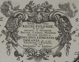
1718 – J. C. Weigel – Poloniae & Lithuania
Title: “Poloniae & Lithuania accurante curatius”
Description:
Rare map of Lithuania, Latvia, Poland, Prussia Belarus and Ukraine. Decorative cartouche with a portrait of the king Augustus II the Strong. Engraver’s signature under the lower frame.
Comes from Weigel’s travel atlas “Bequemer Schul- und Reisen-Atlas” also titled “Atlas scholasticus et itinerarius“ published by Johann Ernst Adelbulner in Nuremberg 1718.
Cartographer: Johann Christoph Weigel (1654-1725)
Sheet size: 38,7 x 30,3 cm
Year: 1718
Technique: copper engraving
Condition:
Good condition. Bottom centerfold separation restored, reinforcement on verso. Brownish frame.
This is an original antique map published in 1718 and not a modern copy or reprint
On your request I will provide a Certificate of Authenticity