1936 – W. Horn – Die Sprache im Lese und Schreibunterricht
25 €
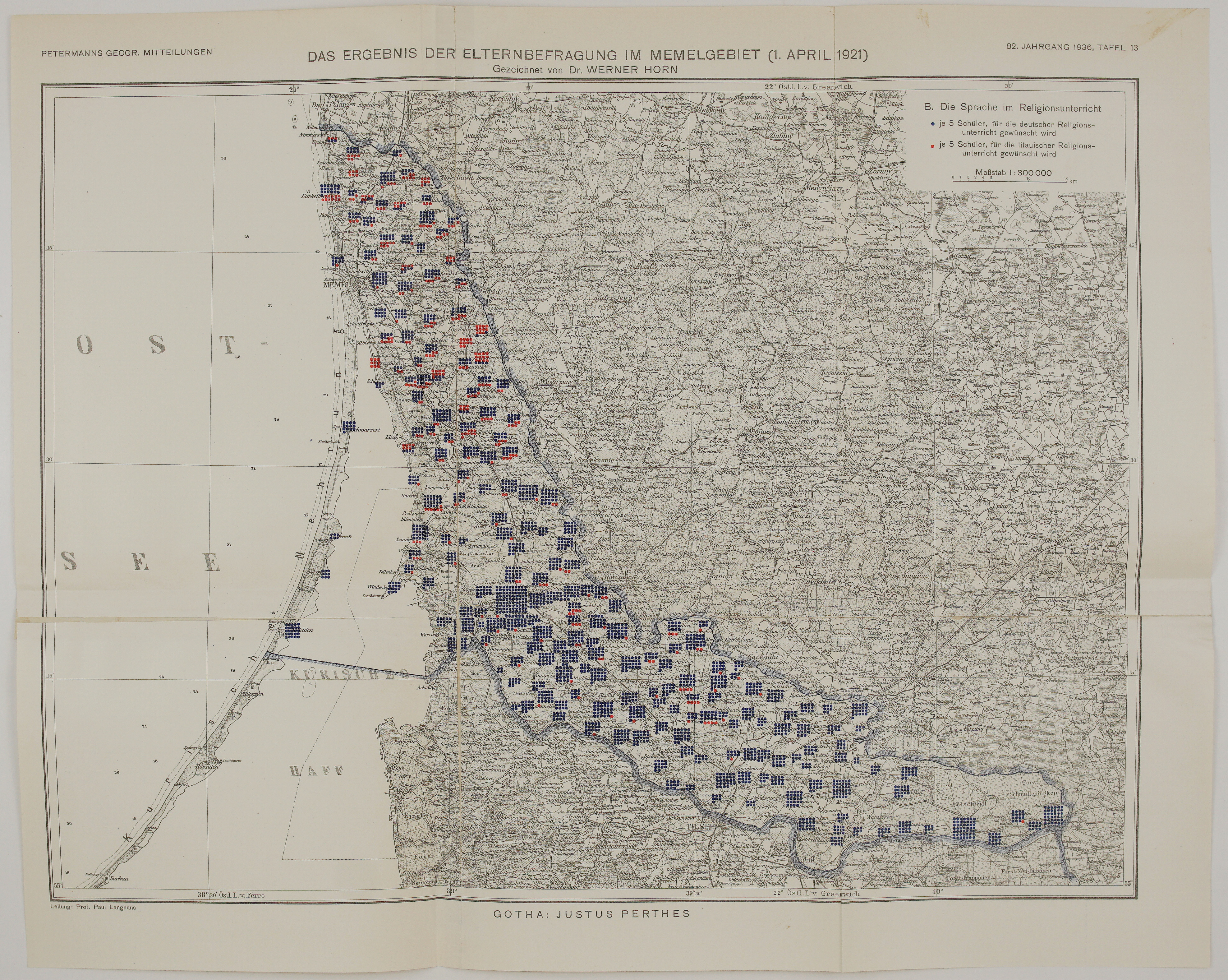
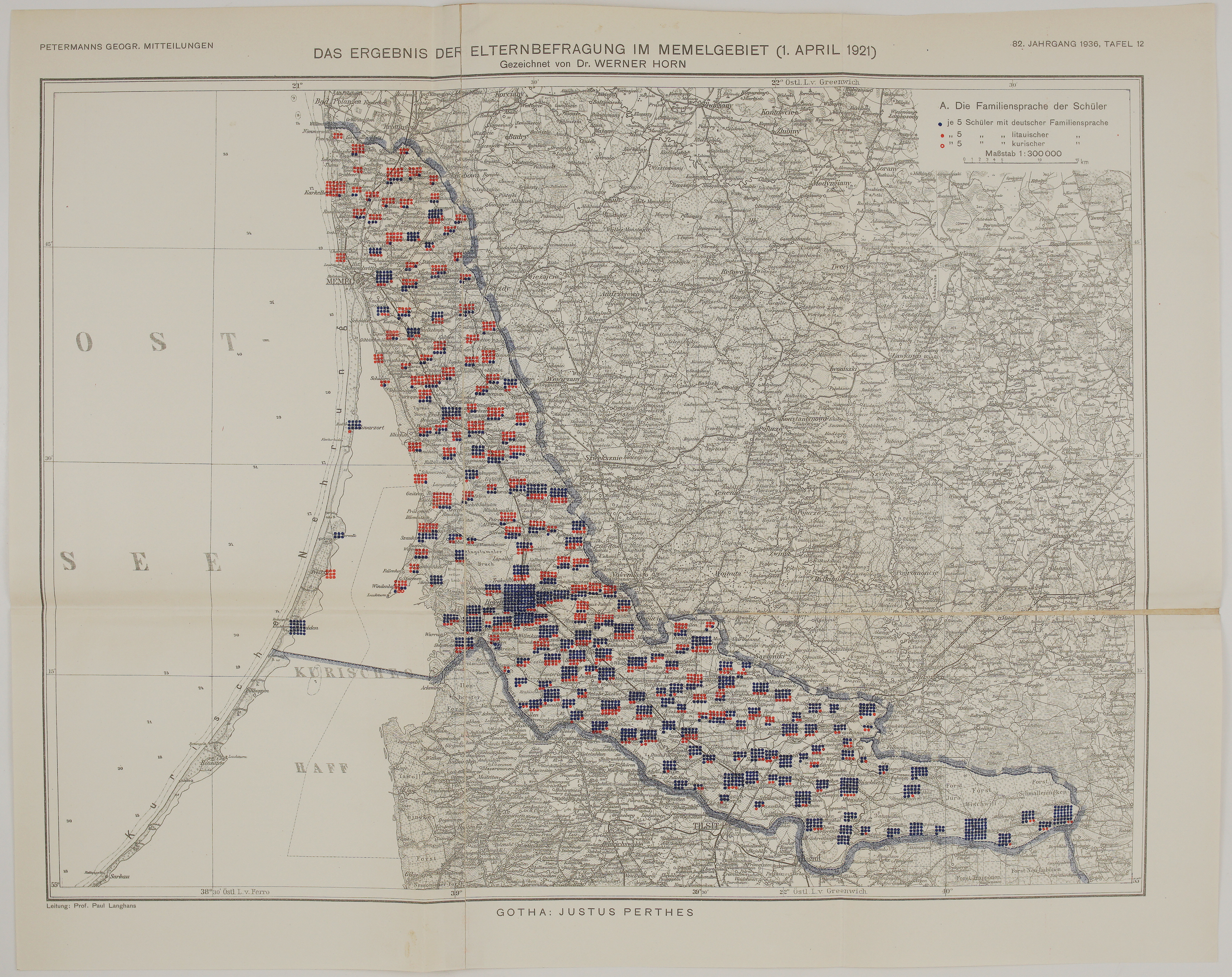
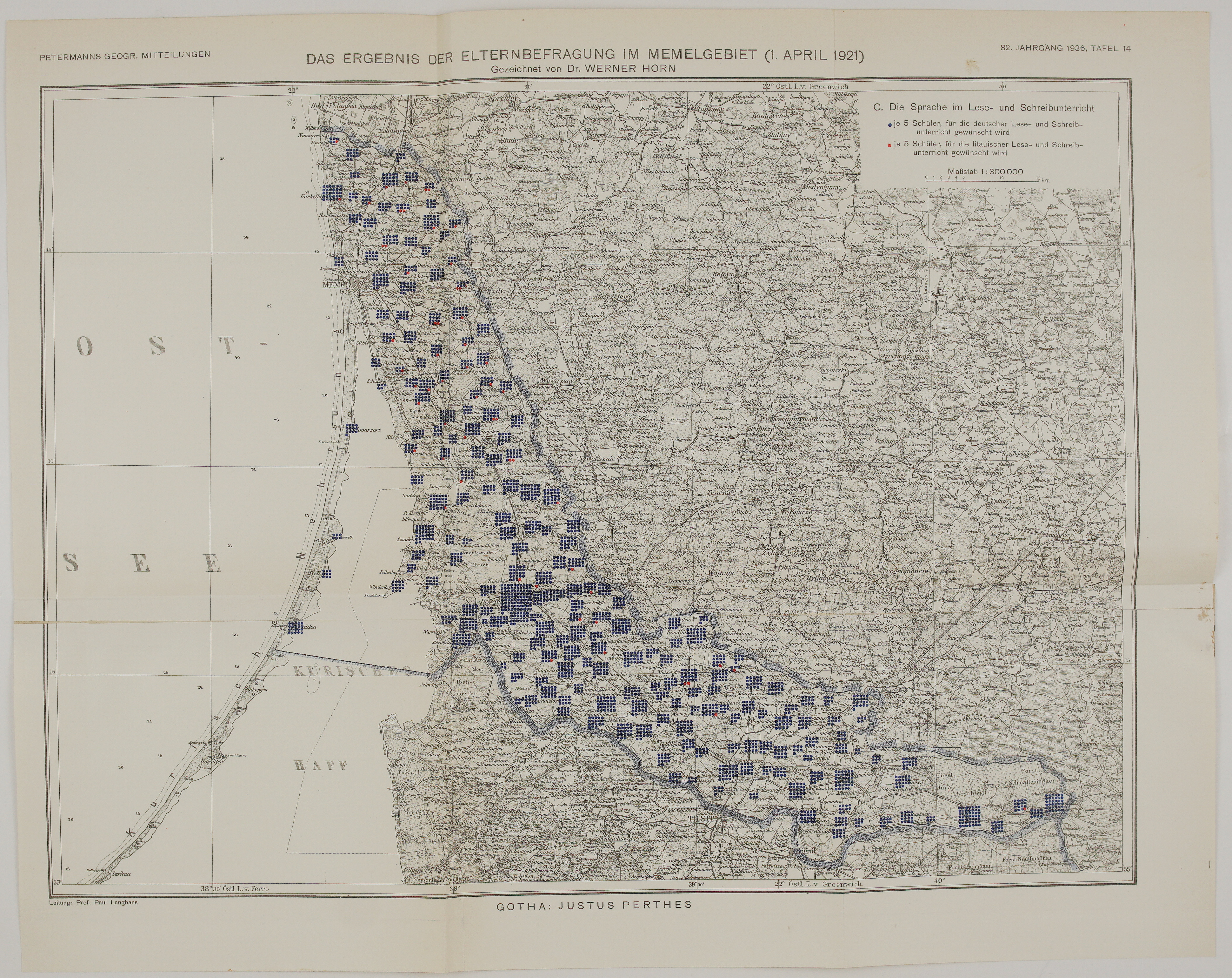
Title: “Das Ergebnis der Elternbefragung im Memelgebiet (1. April 1921). Gezeichnet von Dr. Werner Horn.”
&
“C. Die Sprache im Lese- und Schreibunterricht”
Description:
A detailed map of the language in which the parents of the Memel Territory (Klaipėda Region) wanted their children to learn reading and writing in 1921. Each dot stands for five pupils whose parents asked for reading and writing lessons in German (blue) or in Lithuanian (red). Almost all the dots are blue, and only a few red dots are scattered across the territory: even most Lithuanian-speaking parents chose German for reading and writing.
- The survey: in 1920 the Treaty of Versailles separated the Memel Territory from Germany and placed it under a French administration on behalf of the Allied Powers. By a decree of 14 March 1921, the administration ordered a survey of the parents of the children in the rural schools. On 1 April 1921 the parents stated their family language and the language in which they wanted their children to be taught religion and reading and writing.
- The series: this is plate 14 of seven maps of the Memel Territory drawn by Dr. Werner Horn and published by Justus Perthes in Gotha in Petermanns Geographische Mitteilungen for 1936 (plates 12–18), under the direction of Prof. Paul Langhans. Three plates show the parents’ survey of 1921, and four show the elections to the parliament of the Memel Territory (Landtag; Seimelis) in 1925, 1927, 1930 and 1932.
- The base map: the results are printed in blue and red over a grey topographic map at 1:300,000. It covers the whole Memel Territory, from Nemirseta (Nimmersatt) in the north to Smalininkai (Schmalleningken) in the east, with Klaipėda (Memel), Šilutė (Heydekrug), the Curonian Spit and the Curonian Lagoon. It also covers the neighbouring parts of Lithuania and East Prussia with Palanga (Bad Polangen), Kretinga (Krottingen), Gargždai (Gorzdy) and Tilsit. The border of the territory is marked by a blue band.
Werner Horn (1903–1978) was a German geographer and cartographer in Gotha and later the editor-in-chief of Petermanns Geographische Mitteilungen (1954–1968). The series appeared in 1936, at a time of sharp tension between Germany and Lithuania over the Memel Territory, and it presents the German view of the territory. Today it is an exceptional, detailed record of the languages and politics of Lithuania Minor (Mažoji Lietuva) between the two World Wars.
It is rare on the market.
Cartographer: Werner Horn (1903 – 1978)
Publisher, Place: Justus Perthes, Gotha
Sheet size: 52,7 x 41,7 cm
Year: 1936
Technique: colour lithograph
Condition:
Good condition. Folded as issued. Short splits at both ends of the horizontal fold; small chips and brown spots at the right edge, light toning.
This is an original antique map published in 1936 and NOT a modern copy or reprint
On your request I will provide a Certificate of Authenticity
In stock