- View cart You cannot add another "1772 - J. F. Schmidt - Архангелогородскую Губернию" to your cart.

c. 1750 – Poilly & Mitoire – Grande Pologne
2,000 €
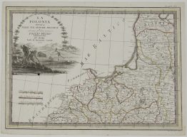
Title: “Grande Pologne”
Description:
Extremely rare set of geographical playing cards including the map centered on Warsaw, Poland.
This set was printed in Paris with a special dedication to the House of Conti, on them could travel around the world without leaving the palace. The full version of the game consisted of a set which included three sets of six decks of cards with thirty page instruction. In it, the author explained the meaning of the idea, the pedagogical effect, possible game options for the best mastery of geography. Each deck of cards has four colors: red, yellow, green and blue. Each suit consisted of 13 cards. Kings and Queen had crowns and Jacks had caps or hats, in accordance with the customs of a particular country. The image of the country’s coat of arms and additional information about the fertility and commerce of the region were placed on the ace card. The King’s card has information about the country (or province) and name of the capital. The Queen’s card contained information about the administrative division of the territory. The Jack’s card – the names of the main rivers. On cards 10, 9, 8, 7, 6, 5, 4, 3, 2 of each suit, the corresponding number of graphic elements were placed: cities with information about the distance between them and the capital, about the rivers on which they are located.
Engraver/Publisher: Nicolas Jean Baptiste de Poilly (1712-1758)
. Jean-Baptiste Mitoire
Sheet size: 11 * 6,2 x 8,5 cm
Year: c. 1750
Technique: copper engraving
Condition:
Very good condition, contemporary hand coloring.
This are an original antique cards published circa 1750 and NOT a modern copy or reprint
On your request I will provide a Certificate of Authenticity
In stock