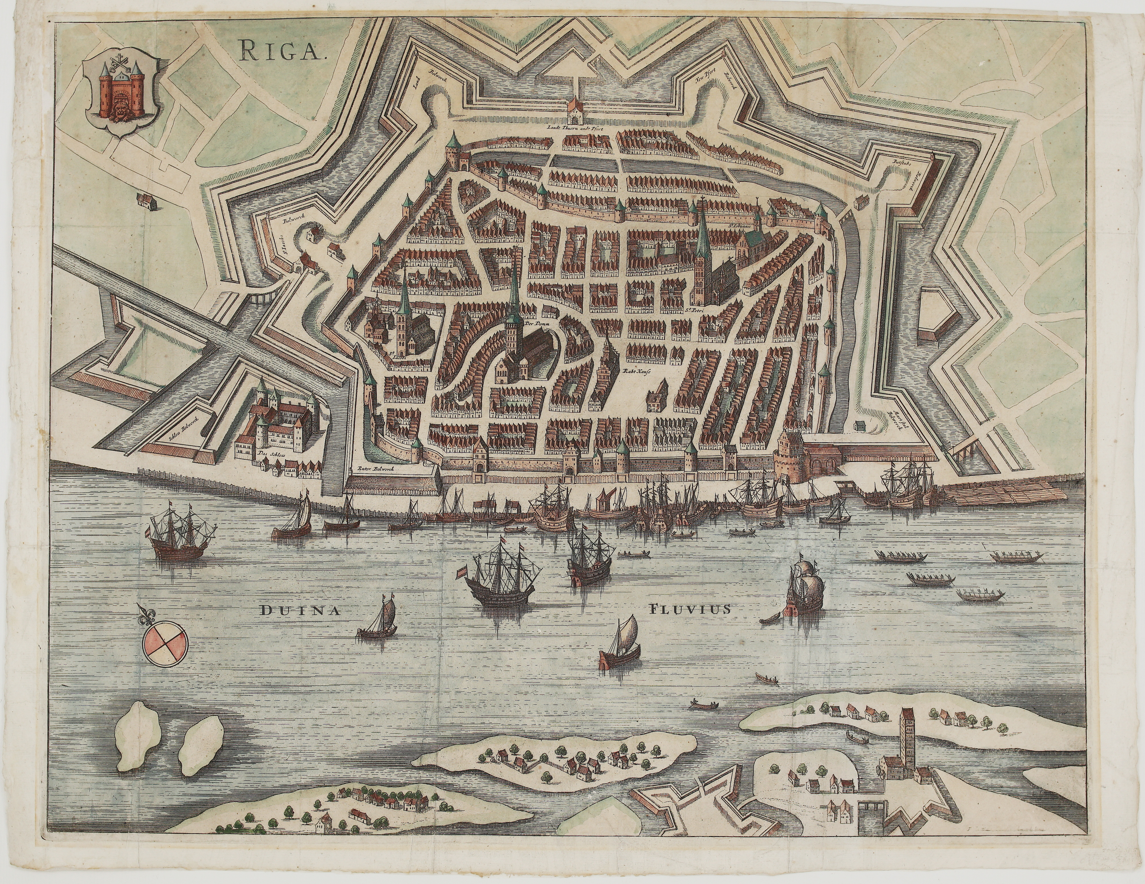
1657 – J. Janssonius – Riga
450 €
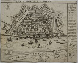
Title: “Riga.”
Description:
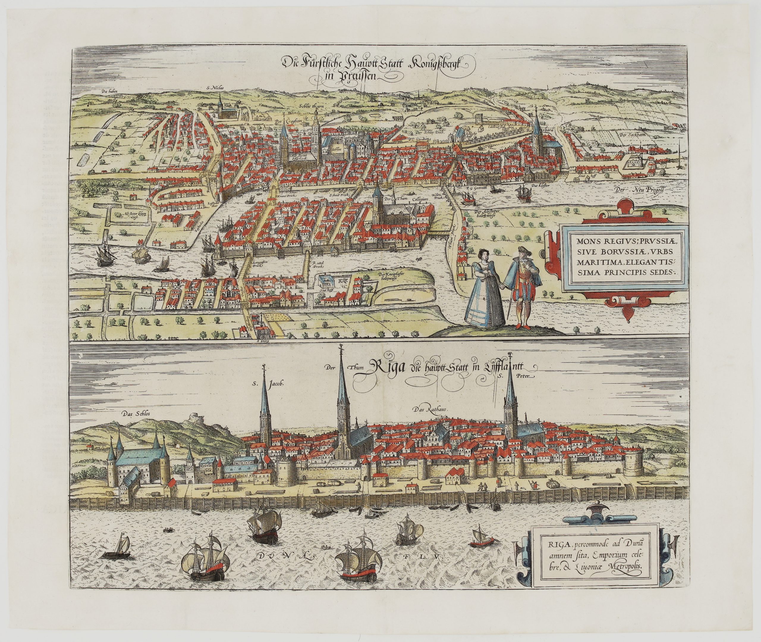
Rare and large bird’s-eye plan of Riga from Johannes Janssonius’s town book of northern Europe, “Illustriorum principumque urbium septentrionalium Europae tabulae”, also issued as “Theatrum praecipuarum urbium positarum ad septentrionalem Europae plagam” (Amsterdam, 1657). It shows Riga under Swedish rule, which began when Gustavus Adolphus captured the city in 1621. The medieval walls with their round towers and gates are surrounded by a ring of star-shaped earthen bastions and water-filled moats.
The plan is drawn from above the left bank of the Daugava, looking across the river at the walled town. Inside the walls, every street and block of gabled houses is drawn, with the main landmarks named in German: “Der Domm” (Riga Cathedral), “St. Petri” (St Peter’s Church), “St. Iohannis” (St John’s), “St. Iacobi” (St James’s) and the “Raht Hauss” (Town Hall). At the western end, behind its own bastion, stands “Das Schloss”, the castle of the Livonian Order. The outer works are labelled one by one: “Landt Thuern undt Pfort”, “Land Bolwerck”, “New Pfort Bolwerck”, “St. Iacobs Bolwerck”, “Batstabe Bolwerck”, “Mart stal Bolwerck”, “Ruter Bolwerck” and “Schloss Bolwerck”.
In front of the city, the “Duina Fluvius” (Daugava) is crowded with merchant ships, small sailing craft and rowing boats along the quay, a reminder of Riga’s role as one of the great trading ports of the Baltic. The foreground shows the river islands with farmsteads and trees, and a bastioned fort on the opposite bank. The coat of arms of Riga (the city gate with two towers, the lion’s head and the crossed keys under a cross) appears in the upper left, and a compass rose sits on the river.
At about 51 x 40 cm, it is one of the largest and most decorative 17th-century plans of Riga, a highlight for any collection of Baltic city views.
Cartographer/Publisher: Johannes Janssonius (1588–1664)
Sheet size: 55,0 x 42,8 cm
Year: 1657
Technique: copper engraving
Condition:
Good. Strong impression. Old folds flattened, with light creasing; some soiling and small stains in the margins; edges slightly irregular. Attractive hand coloring
This is an original antique map published in 1657 and NOT a modern copy or reprint
On your request we will provide a Certificate of Authenticity
In stock