1493 – H. Schedel – Secunda etas mundi
Title: “Secunda etas mundi”
Description:
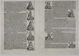
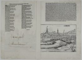
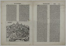
Hartmann Schedel’s fantastic incunabula World map, first edition (latin), based on the cartographic system of Claudius Ptolemy ‘Geographia‘, extending from North Africa and Anglia in the east to India in the west, omitting North and South America, Scandinavia, the southern part of Africa, and the Far East. The map provides a window onto the late medieval imagination. The border contains twelve dour wind-heads, while the map is supported in three of its corners by the solemn figures of Ham, Shem and Japhet taken from the Old Testament.
Most remarkable are the panels representing creatures that were thought to inhabit the furthermost parts of the earth. There are seven such scenes on recto and fourteen on verso. Among the scenes are a six-armed man, a centaur, a four-eyed man from a coastal tribe in Ethiopia, a dog-headed man from the Simien Mountains, a cyclops, a man with a single giant foot, a man with a huge lower lip, a man with ears hanging down to his waist, and other frightening and fanciful creatures.
Woodcut images were made in the workshop of Michael Wolgemut who was an early teacher of Albrecht Dürer and his stepson Wilhelm Pleydenwurff. The printing was carried out under the supervision of the great scholar-printer Anton Koberger, whose printing were famous throughout Europe.
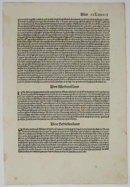
Page comes from the richest illustrated Incunable: Liber chronicarum or Nuremberg Chronicle, published the year that Columbus returned to Europe after discovering America. The Nuremberg Chronicles was the first printed history of the known world with about 2000 woodcuts the most picturesque work of the early time of printing. It became one of the most popular books of the 15th. century.
Cartographer: Hartmann Schedel (1440 – 1514)
Sheet size: 56,8 x 41,4 cm
Year: 1493
Technique: wood block
Condition:
Good condition compare to the age! Strong press on watermarked paper. Left lower text block professionally redrawn by hand on the paper from the same book. Beautiful hand coloring. Left and right sides splits restored.
This is an original antique map published in 1493 and NOT a modern copy or reprint
On your request we will provide a Certificate of Authenticity