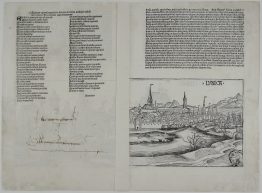
1732 – M. Seutter – Breslau
Titles: “Wratislavia Antiquissima et Celeberrima Ducat. Silesiaci Metropolis…” & “Breslau due Uhralte u Hochberuhmte Haupt Statt des Herzogth. Schleisien…”
Description:
Detailed plan of the city of Wrocław, Poland, viewed from the southwest. The bird’s-eye plan shows the city surrounded by water, with the River Oder at top. Two large market squares dominate the city centre, while Cathedral Island is shown at far right. At the bottom there is a beautiful cityscape. Numbered keys identify 36 locations and detailed city description in German.
Comes from M. Seutter atlas “Atlas Novus sive Tabulae geographicae totius Orbis Faciem, Partes, Imperia, Regna et Provincias exhibentes” published in Augsburg, 1732.
Cartographer: Matthaeus Seutter (1678 – 1757)
Sheet size: 61,8 x 52,6 cm
Year: 1732
Technique: copper engraving
Condition:
Good condition.
This is an original antique map published in 1732 and NOT a modern copy or reprint
On your request I will provide a Certificate of Authenticity