1749 – Homann Heirs – Status Genuensis
250 €
Titles: “Mappa Geographica Status Genuensis ex Subsidiis Recentissimis Præcipue Vero ex Majori Mappa du Chafrion…” & “Carta Geograica, la quale rappresenta lo Stato della Republica di Genova partita nella Riviera di Levante et di Ponente. Data in publico per gli gli Heredi d’Homann”
Description:
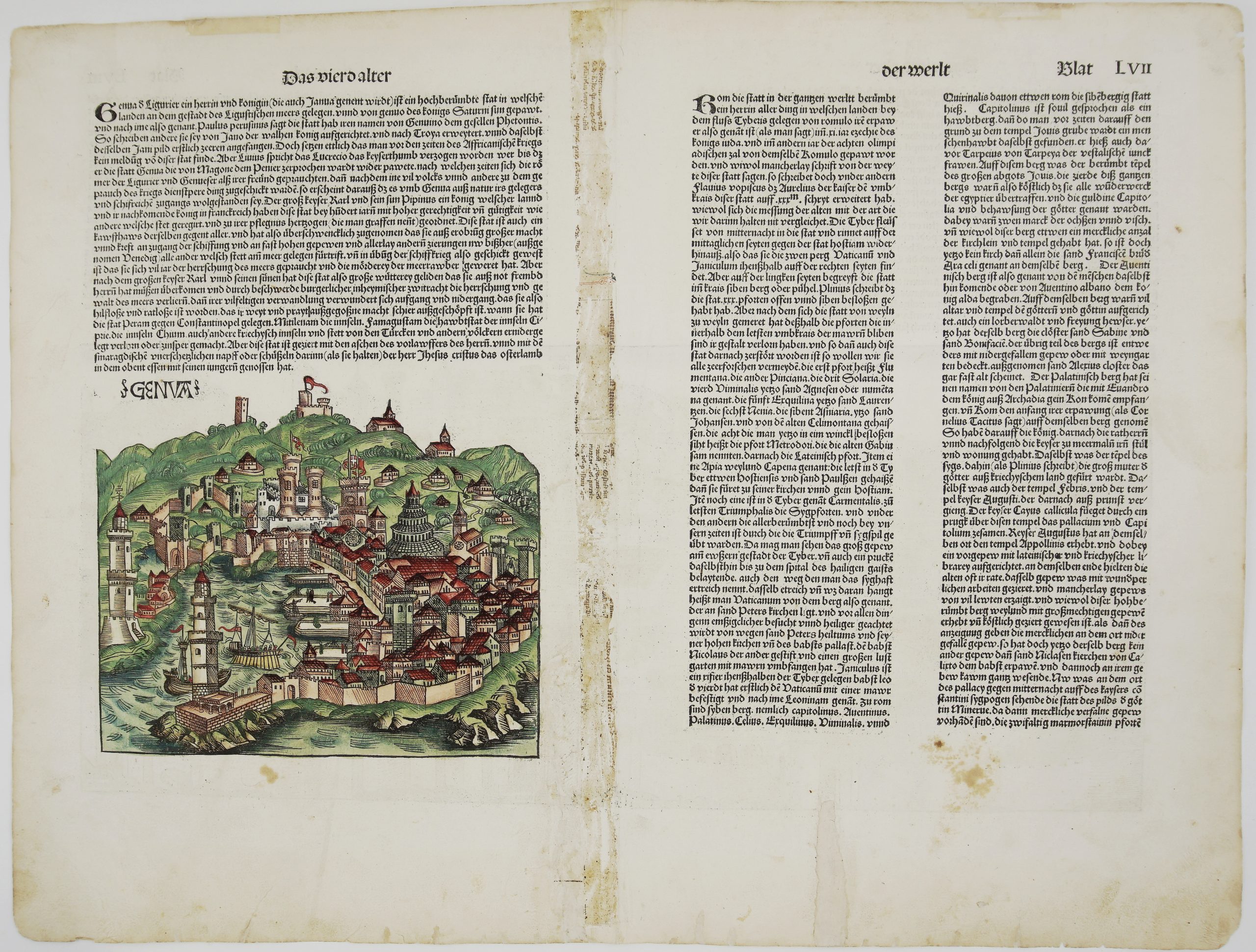
A very detailed and decorative Homann Heirs map of the Republic of Genoa, Liguria, Italy. It extends from Monaco and Ventimiglia until Massa, La Spezia in the east and north until Torino and Parma. It shows Asti, Alessandria, Tortona, Albenga, Finale Ligure, Savona, Genoa, Rapallo, Sestri, Porto Venere, Sarzana and many more.
Comes from Homan’s atlas “Grosser Atlas ueber die ganze Welt” contributed by Johann-Friedrich Betgen, engraved and issued by Homann Heirs publishing house in Nürnberg, 1749.
Cartographer: Johann Baptist Homann (1664-1724)
Sheet size: 60,4 x 49,7 cm
Year: Nürnberg, 1749
Technique: copper engraving
Condition:
Good condition. Watermarked paper. Contemporary coloring. Some staining and toning. Bottom central fold with short repaired tears to the margin just entering the borderline. Few wormholes present too.
This is an original antique map published in 1749 and NOT a modern copy or reprint
On your request I will provide a Certificate of Authenticity
In stock