1777 – L. Brion – III. D’Alemagne
20 €
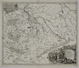
Title: “III. Carte de L’Alemagne Comprenant les Cercles de Baviere, d’Autiche et de Souabe, avec la Suisse.”
Description:
Decorative map of the south eastern Germany. Showing the area from Bavaria and what was Bohemia, down to the Gulf of Venice in the south; parts of modern Austria and Hungary.
The map comes from the atlas “Atlas, et Tables élémentaires de Géographie, ancienne et moderne; Adopté par plusiuers Ecoles Royales Militaires. Nouvelle Édition.“ engraved by M. André after drawings by Brion de la Tour, published in Paris 1777.
Cartographer: Louis Brion de la Tour (1743-1803)
Sheet size: 24,0 x 18,7 cm
Year: 1777
Technique: copper engraving
Condition:
Good, original condition. Contemporary outline coloring, watermarked paper.
This is an original antique map published in 1777 and NOT a modern copy or reprint
On your request I will provide a Certificate of Authenticity
In stock