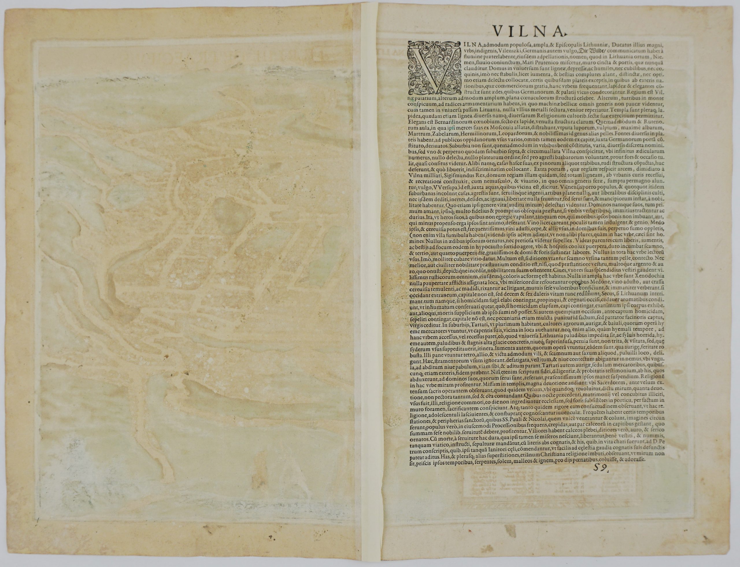
1778 – T. C. Lotter – Magnus Ducatus Lithuania
Title: “Magnus ducatus Lithuania in suos palatinatus et castellanias divisa, non solum accuratissime delineata, sed etiam plurimis in aliis mappis omissis locis aucta cura et sumptibus Tob.Conr.Lotter, Geogr. et Chalcogr. Aug.Vind :”
Description:
Rare and very detailed map of Grand Duchy of Lithuania. This is unique map because it shows territories of Grand Duchy of Lithuania without Samogitia (Žemaitija). It also represents the regions of Polocensis, Witepskiernsis, Miadzial, Trocensis, Vilnensis, Novogrodensiz, Bressicensis, Pinscensis, Modziriae, Mrzeczycensis, Rohaczoviense, Mohiloviensis, Mscislaw, Orsa, Minsciens and others.
The map comes from the atlas „Atlas géographique de cent et huit cartes générales et spéciales / par les géographes Tobie Conrad Lotter, Matthieu Seutter, et Jan-Michel Probst a Augsburg et par les Heritiers de Homan a Nurnberg, 1778″ engraved by Georg Friedrich Lotter, published in Nurnberg, 1778.
Cartographer: Tobias Conrad Lotter ( 1717 – 1777 )
Sheet size: 53,7 x 65,7 cm
Year: 1778
Technique: copper engraving
Condition:
Very good condition. Original, contemporary, hand coloring, watermarked paper. Three tiny wormholes present. Center fold as published.
This is an original antique map published in 1778 and not a modern copy or reprint
On your request I will provide a Certificate of Authenticity