1693 – N. de Fer – Calais
50 €
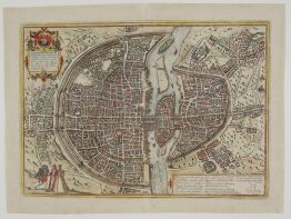
Title: “CALAIS, Ville Forts de Proar Zie, a 51. Degrez 1. Mimite de Latitude,, et 33. Degrez’s Minude Longitude Fort de Mer fituée dans la Terre, eu Comté d’Oye Lan.5557 les François qua laporredet encore aujourd hany Laprirent fur les Angloie fow le Regne de François Second, et four la conchate de Français Duc Le Guife”
Description:
Very decorative plan of the fortified town of Calais, including Forts Nieulay and Risban, France. The text provides historical and geographical information about the location.
The engraving comes from the Nicolas de Fer atlas “Les Forces de l’Europe, ou Description des principales villes, avec leurs fortifications.” engraved by Herman van Loon, published in Paris, 1693.
Cartographer: Nicolas de Fer (1646 – 1720)
Sheet size: 34,0 x 29,7 cm
Year: 1693
Technique: copper engraving
Condition:
Good, original condition.
This is an original antique map published in 1693 and NOT a modern copy or reprint
On your request I will provide a Certificate of Authenticity
In stock