1606 – P. Bertius – Polonia
250 €
Title: “Polonia”
Description:
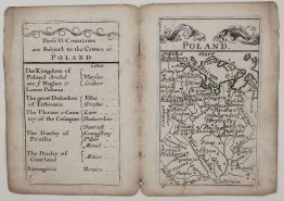
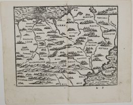
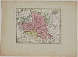
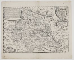
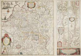
A charming small map of Poland and the Grand Duchy of Lithuania from Petrus Bertius’s Latin pocket atlas, Tabularum Geographicarum Contractarum Libri Quinque, published in Amsterdam by Cornelis Claesz. It is printed from the original plates of Barent Langenes’s Caert-Thresoor of 1598, the first Dutch pocket atlas, engraved in the workshop of Jodocus Hondius and Pieter van den Keere. Bertius wrote a new Latin text for them, and the atlas became one of the most popular small atlases of the 17th century. For the editions of 1616 and later, the plates were re-engraved on a larger scale.
The map covers the Commonwealth from Frankfurt on the Oder and Silesia to Kyiv and the Dnieper, and from the Baltic coast at Königsberg and Danzig down to Moldavia:
- Lithuania: Vilnius (“Vilna”), Trakai (“Troky”), Kaunas (“Kowno”), Krėva (“Crewa”), Vilkija (“Wylkya”), Betygala, Merkinė (“Merecz”), Ragnit and Borisov, with the rivers Neris (“Vilia”) and Berezina.
- The east: Kobryn, Kletsk (“Kloczko”), Kapyl, Mozyr, Zhytomyr (“Sytomiers”), Kyiv (“Kyow”) and Kaniv, among dense forests.
- Poland: Warsaw, Kraków, Toruń, Chełmno (“Culm”) and Włocławek (“Waldislavia”).
The borders of Poland and Lithuania are coloured, the forests are drawn as little trees, and the sea is engraved in a wavy pattern. The title sits in a strapwork cartouche in the lower left, with a scale of German miles in the upper left.
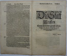
On the back is the opening of Bertius’s Latin “Descriptio Poloniae” (page 439):
- Sarmatia: European Sarmatia “largely obeys the King of Poland”, and comprises Poland, Lithuania, Samogitia, Masovia, Volhynia, Podolia, Ruthenia and Moldavia.
- The name: Poland takes its name from its plains, “for that is what Pole means”.
- Greater Poland: Bertius describes Poznań with its double wall and brick houses, and Międzyrzecz, “whose houses are all of wood”.
- Gniezno: the first city founded by Lech, where Bolesław the Brave received the royal crown from Emperor Otto III, and where the body of St Adalbert, Bishop of Prague, rests in the cathedral.
Cartographer: Petrus Bertius (1565 – 1629), after Barent Langenes
Sheet size: 18.3 x 11.8 cm
Year: 1606
Technique: copper engraving
Condition:
Good condition. Attractive hand coloring. Remnants of old paper hinges on the verso, showing as a few brownish spots in the margins.
This is an original antique map published in 1606 and NOT a modern copy or reprint
On your request I will provide a Certificate of Authenticity
In stock