1693 – R. Morden – Poland
250 €
Title: “Poland by Robert Morden”
Description:
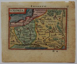
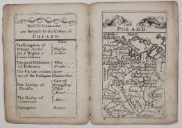
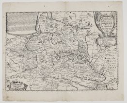
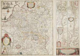
A charming small English Morden map of Poland and Lithuania, from Robert Morden’s Geography Rectified: or, a Description of the World, published in London. As in the book, the map is printed within the text, below the heading “Of Poland” on page 80.
The map covers the Polish-Lithuanian Commonwealth from the Baltic to the Black Sea:
- Lithuania: Samogitia with Raseiniai (“Rosinie”), Kaunas, Trakai, Vilnius (“Vilna”) and Ashmyany (“Osmiana”). Further south and east are Grodno, Lida, Navahrudak, Slonim, Minsk, Brest, Pinsk, Polotsk, Vitebsk, Mogilev and Smolensk.
- The Baltic: Courland and Livonia, with Riga, Mitau, Windau, Kokenhausen and Dünaburg, and Ducal and Royal Prussia with Königsberg, Danzig, Elbing and Thorn.
- Poland: Masovia with Warsaw, Greater and Lesser Poland, Cracow, Lublin and Lviv.
- The south: Volhynia, Podolia and the Ukraine, with Kyiv, Cherkasy, the Cossacks (“Cosaques”) and the Kodak fortress on the Dnieper, down to Bilhorod, Ochakiv and the Black Sea.
Several names are in French (“Mer Noire”, “Cosaques”, “Russia Petite”, “Allemagne”), which shows that Morden copied his map from a French model.
The text below the map opens the chapter on Poland. It gives the country’s name in five languages and explains that Poland, “which was formerly but a part of Sarmatia, is now a Kingdom of as large extent as any in Europe”.
On the back (page 79) is the end of the chapter on Muscovy:
- Kazan and Astrakhan: Kazan’s walls and towers are of wood. Astrakhan is defended by 500 brass cannon.
- The vegetable lamb: the plant “Zoophyte, that resembles a Lamb”, which bleeds when cut and is devoured greedily by wolves.
- Siberia: a land of the richest furs, “whither the Lords in disgrace are banish’d”.
- The church: Muscovy has “one Patriarch, four Archbishopricks, eighteen Bishops, and no University”.
Robert Morden (died 1703) was a London bookseller, map publisher and globe maker, working at the sign of the Atlas in Cornhill. Geography Rectified was his popular geography for English readers. It first appeared in 1680 and was enlarged in the editions of 1688, 1693 and 1700.
Cartographer: Robert Morden ( 1650 – 1703)
Sheet size: 19,7 x 16,1 cm
Year: 1693
Technique: copper engraving
Condition:
Good condition. Watermarked paper.
This is an original antique map published in 1693 and not a modern copy or reprint
On your request I will provide a Certificate of Authenticity
In stock