1705 – P. Schenk – Alsatiae Tabula
100 €
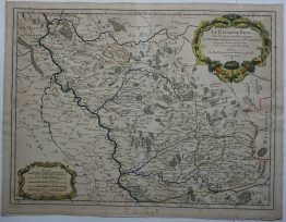
Title: “Superioris atque Inferioris Alsatiae Tabula perquam Accurata et Exacta; Proximis Regionibus…”
Description:
The rare and detailed map of the Alsace region, France, from Basel in the south to Philipsburg in the north, centered on Strasburg, by Nicolas Sanson, published by Petrus Schenk.
Comes from the atlas “Contractus sive Mapparum Geographicarum Sansoniarum auctarum et correctarum Nova Congeries. ” prepared by Sanson, published in Amsterdam by Petrus Schenk, 1705.
Publisher: Petrus Schenk (1660 – 1718)
Sheet size: 59,0 x 50,4 cm
Year: 1705
Technique: copper engraving
Condition:
Good condition. Few lightly brownish areas present.
This is an original antique map published in 1705 and NOT a modern copy or reprint
On your request I will provide a Certificate of Authenticity.
In stock