- View cart You cannot add that amount to the cart — we have 1 in stock and you already have 1 in your cart.


1897 – A. Stieler – Hand-Atlas
300 €
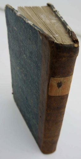
Title: “Handatlas über alle Theile der Erde und über das Weltgebäude Herausgegeben von Adolf Stieler Gotha Justus Perthes”
Description:
Attractive, complete atlas of the World with 90 colored maps published by Justus Perthes in Gotha. Stielers Handatlas was the leading German atlas of the second half of 19th century and first quarter of 20th century.
Cartographer/Publisher: Adolf Stieler (1775–1836)
Atlas size: 39 cm x 28 cm x 4 cm
Year: 1897
Technique: lithography
Condition:
Good, original condition. Some soiling, toning, and occasional foxing, mostly to margins, bumped corners.
This is an original antique atlas published in 1897 and NOT a modern copy or reprint
On your request we will provide a Certificate of Authenticity.
In stock