1704 – G. Bodenehr – Königreiche Polen und Preussen
250 €
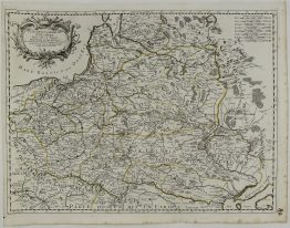
Title: “Geographische Vorstellung derer Königreiche Polen und Preussen mit deren incorporierten Landen”
Description:
Small and decorative map of the Polish – Lithuanian Commonwealth including territories of Prussia, Belarus and the routes used by the Tartars to invade Poland.
Comes from atlas “Atlas Curieux oder Neuer und Compendieuser Atlas…” published in Augsburg 1704.
Cartographer: Gabriel Bodenehr (1673 – 1765)
Sheet size: 31,0 x 20,0 cm
Year: 1704
Technique: copper engraving
Condition:
Good condition.
This is an original antique map published in 1704 and NOT a modern copy or reprint
On your request I will provide a Certificate of Authenticity.
In stock