1717 – N. de Fer – Estats de la Couronne de Pologne
400 €
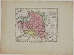
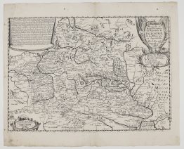
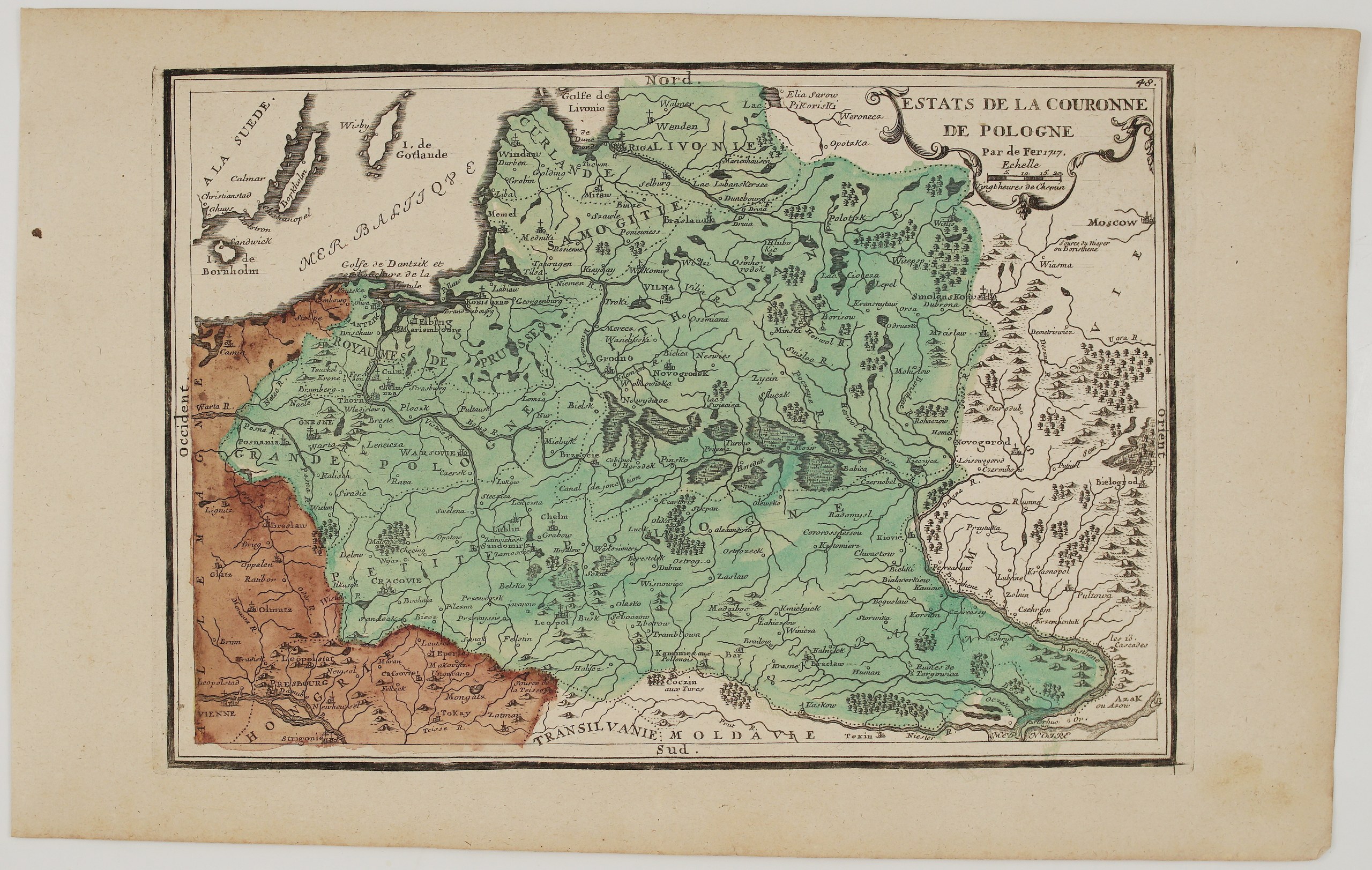
Title: “Estats de la Couronne de Pologne. Par de Fer 1717.”
(The States of the Crown of Poland)
Description:
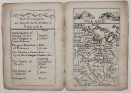
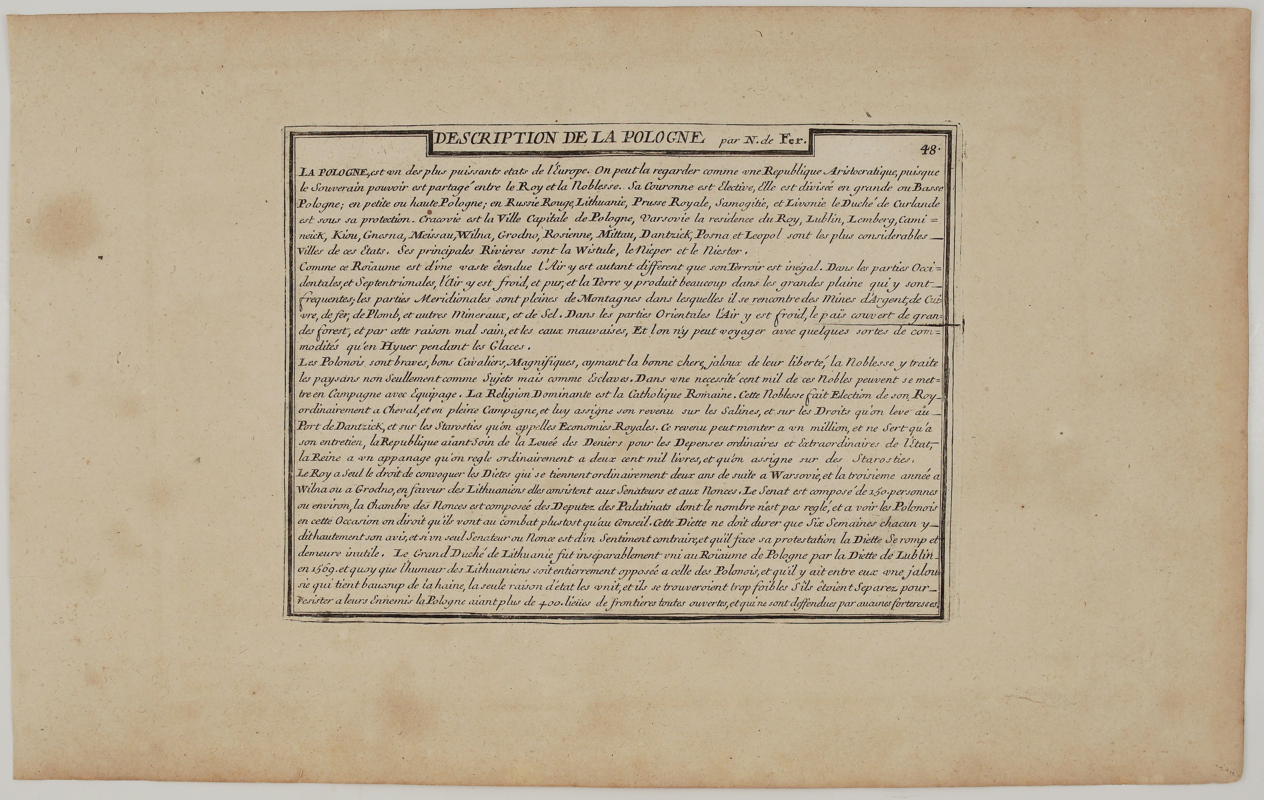
An attractive map of the Polish-Lithuanian Commonwealth by Nicolas de Fer, rare edition, Geographer to the King of France, from his L’Atlas Curieux ou le Monde représenté, published in Paris. The plate is numbered 48 and dated 1717. On the back is the matching engraved “Description de la Pologne par N. de Fer”, also numbered 48, as issued in the atlas.
The map covers the Commonwealth from Pomerania, Silesia and Hungary to Smolensk, Kyiv and the Sea of Azov, and from Courland, Livonia and Gotland down to Moldavia and the Black Sea:
- Lithuania: Vilnius (“Vilna”), Trakai (“Troki”), Kėdainiai (“Kieydany”), Ukmergė (“Wilkomir”), Panevėžys (“Poniewiess”), Šiauliai (“Szawle”), Raseiniai (“Rosienne”), Tauragė (“Tauragen”), Merkinė (“Merecz”), Grodno, Navahrudak, Nesvizh, Minsk, Polotsk and Vitebsk.
- The Baltic: Courland with Mitau, Windau and Libau, and Livonia with Riga, Wenden and Dünaburg.
- The south: Podolia, Ukraine with Kyiv and Bila Tserkva, the thirteen rapids of the Dnieper (“les 13 Cascades”), the “Ruines de Targowica”, and Khotyn “aux Turcs”.
- A canal: south of Pinsk a “Canal de jonction” is marked, linking the Bug and Pripyat river systems. A canal there, the Royal Canal, was only built in 1775–1784.
A scrolling Rococo cartouche in the upper right holds the title and a scale in “heures de chemin” (hours of travel).
The engraved description gives a lively French portrait of the Commonwealth:
- Government: Poland is “one of the most powerful states in Europe”, best regarded as “an aristocratic republic, since sovereign power is shared between the King and the nobility”. The crown is elective, and the nobles elect their king on horseback in the open field.
- The Diets: they are held two years running in Warsaw and every third year in Vilnius or Grodno, “in favour of the Lithuanians”. Watching the Poles there, “one would say they go to battle rather than to council”, and a single protest breaks up the Diet.
- The union: the Grand Duchy of Lithuania was “inseparably united” with Poland by the Diet of Lublin in 1569. De Fer adds that, although the Lithuanians’ temper is entirely opposed to the Poles’, only reason of state holds them together, as each would be too weak alone.
- The country: the eastern lands are so full of great forests that one can travel there comfortably only in winter, when everything is frozen.
Nicolas de Fer (1646–1720) was one of the most prolific French map publishers of his time. His Atlas Curieux was issued in parts from 1700 and later continued with new plates, to which this 1717 map belongs.
Cartographer: Nicolas de Fer (1646 – 1720)
Sheet size: 2 sheets 41,7 x 26,2 cm
Year: 1717
Technique: copper engraving
Condition:
Good condition. Watermarked paper. Contemporary coloring. Light toning to the margins and a small spot in the left margin.
This is an original antique map published in 1717 and NOT a modern copy or reprint
On your request I will provide a Certificate of Authenticity
In stock