1758 – E. Lubinus – Pomeraniae Descriptio (6 sheets)
2,500 €
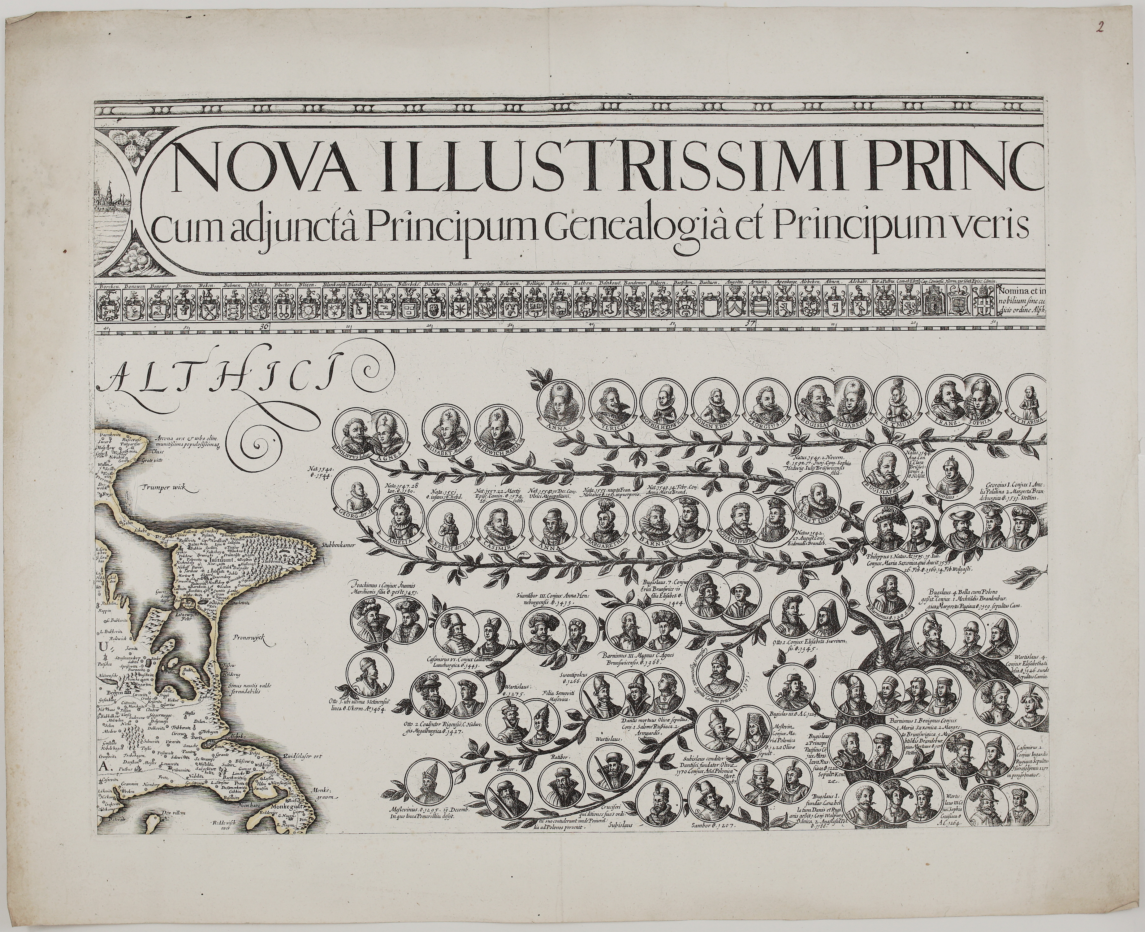
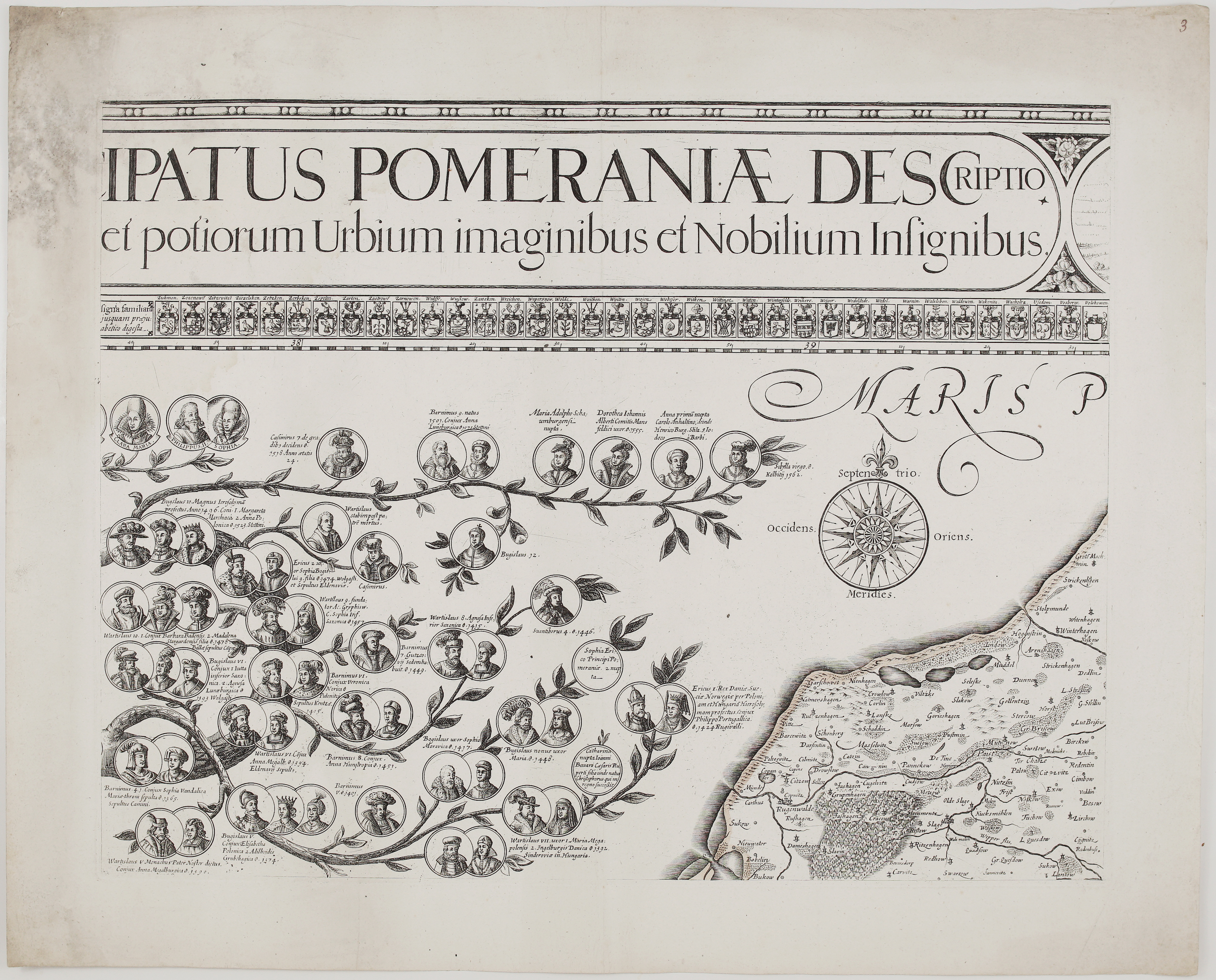
Title: “Nova Illustrissimi Principatus Pomeraniae Descriptio cum adjuncta Principum Genealogia et Principum veris et potiorum Urbium imaginibus et Nobilium Insignibus.”
&
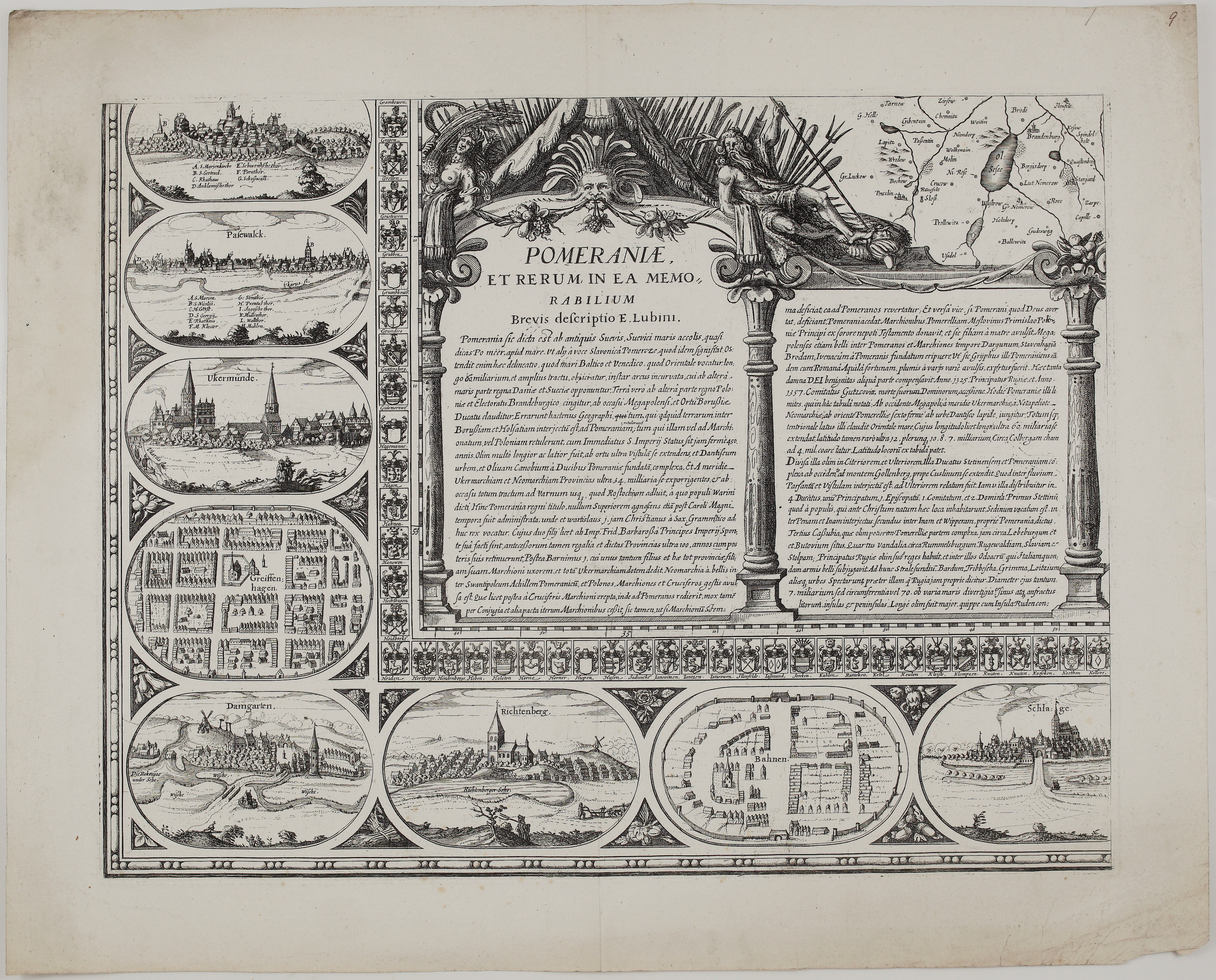
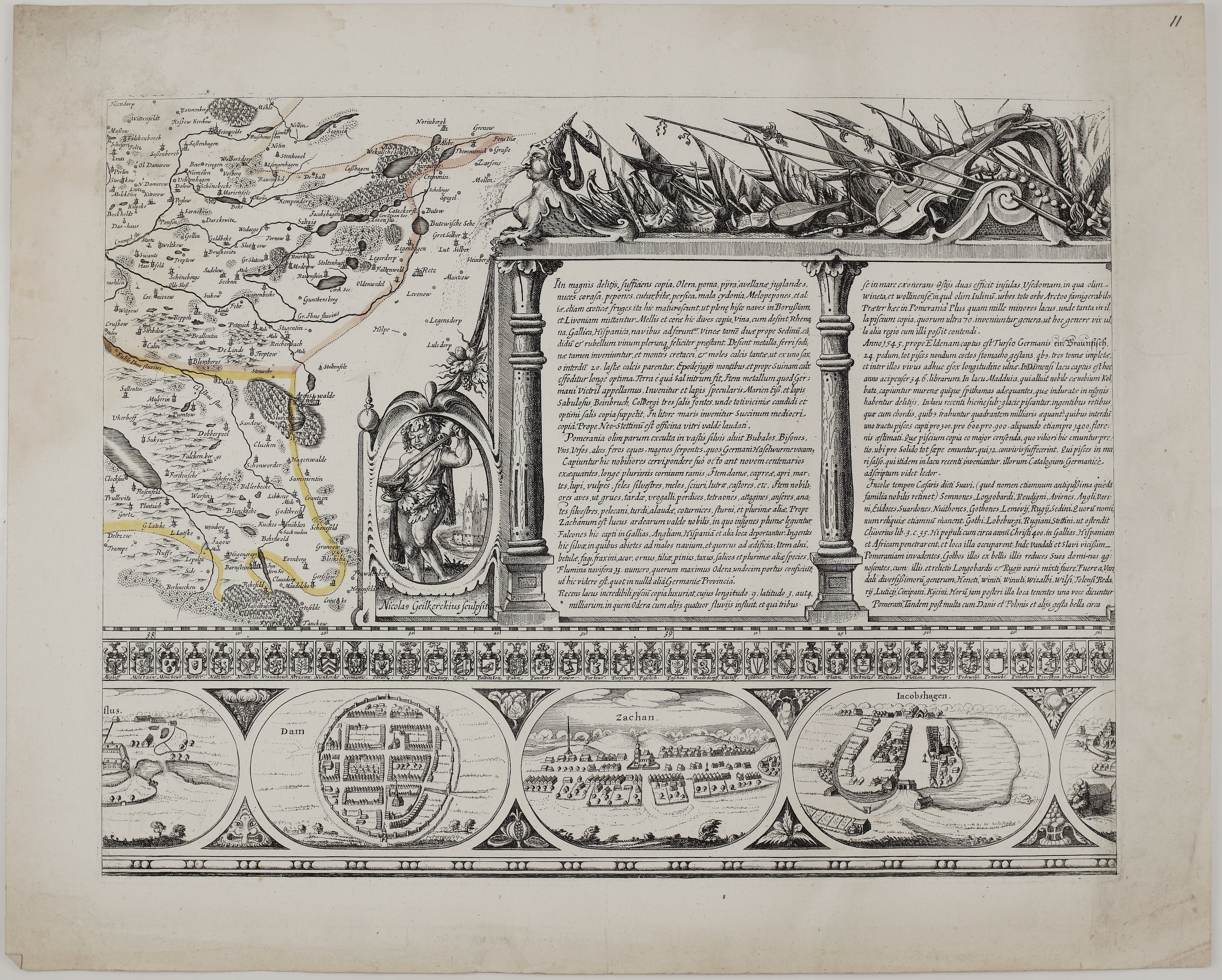
“Pomeraniae et rerum in ea memorabilium brevis descriptio E. Lubini” … “Nicolas Geilkerckius sculpsit”
Description:
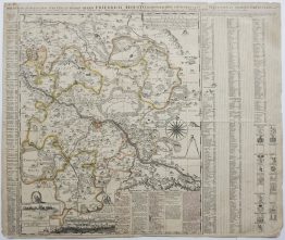
Six original sheets from the “Große Lubinsche Karte”, the great wall map of the Duchy of Pomerania and one of the most splendid regional maps of the 17th century. Duke Philipp II of Pomerania-Stettin commissioned it from Eilhard Lubinus (Lübben), professor at the University of Rostock, who surveyed the whole duchy himself. The map was engraved in Amsterdam by Nicolaes Geilkercken on twelve copper plates. Assembled, they form a map of about 221 x 125 cm, with the Griffin dynasty’s family tree, 49 town views and the coats of arms of 353 noble families. Only a few proof copies were printed in 1618, and they are virtually unobtainable. The plates were rediscovered in 1756 and reprinted in 1758, the edition in which the map is usually found today.
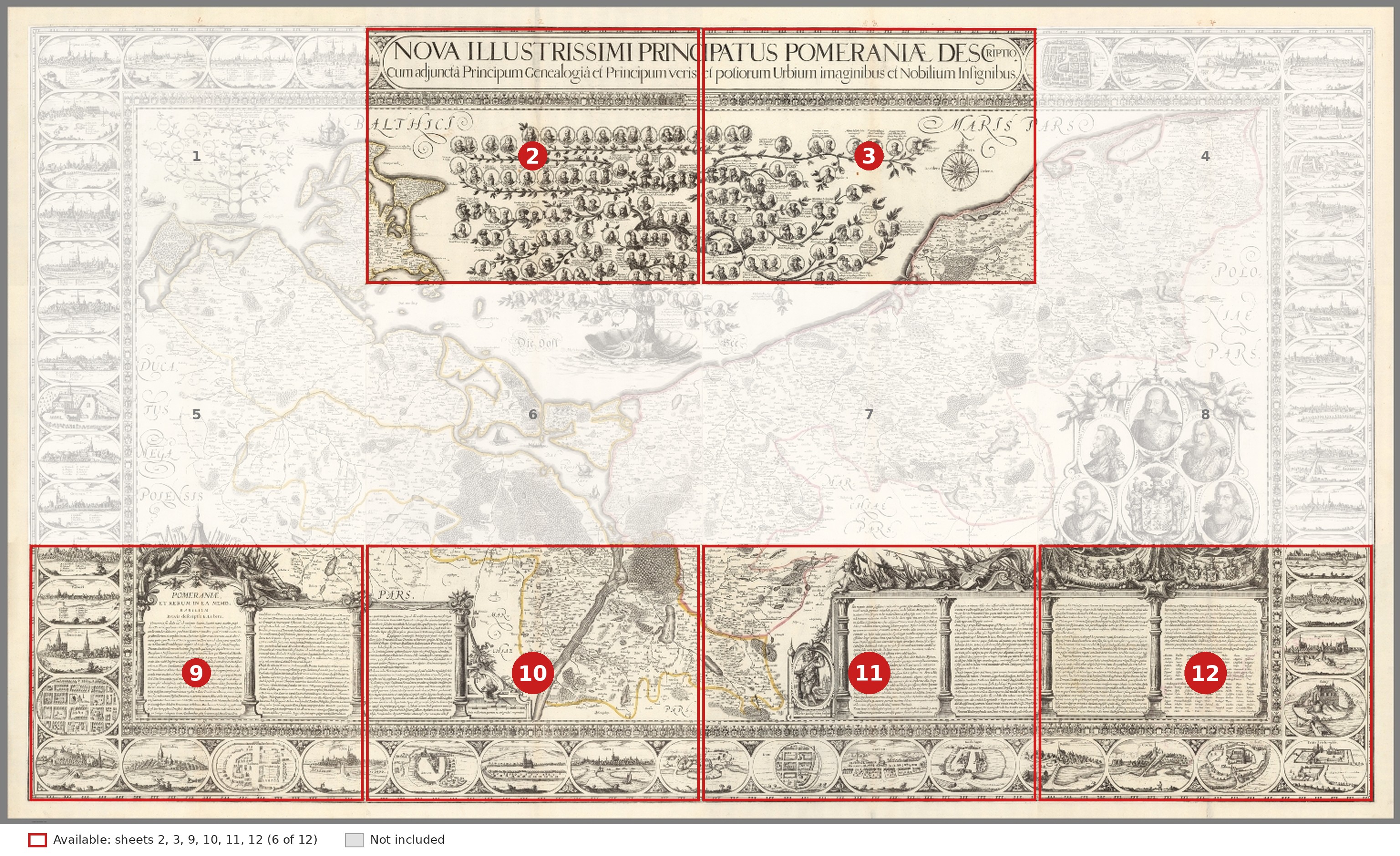
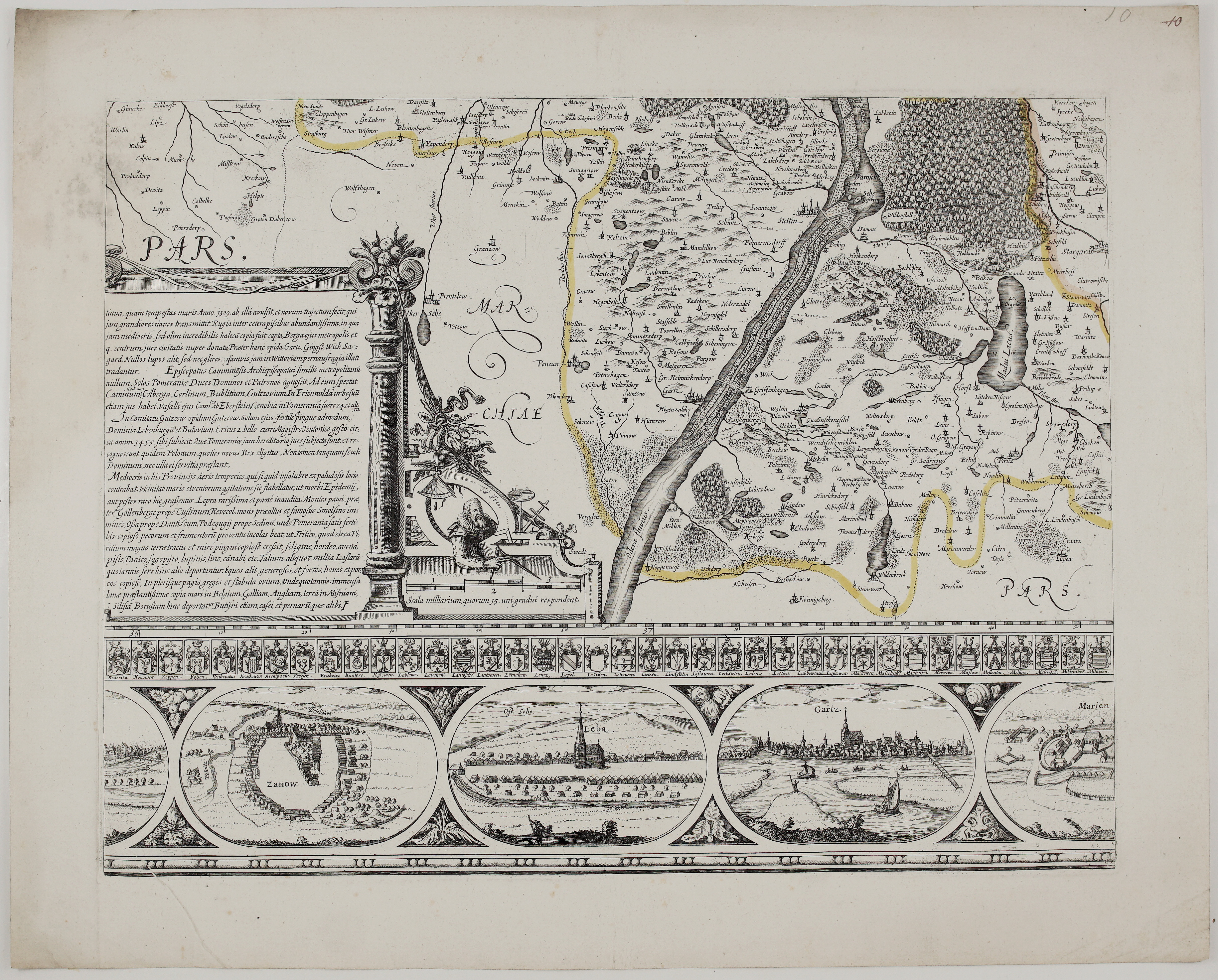
This group contains six of the twelve sheets: the two central sheets of the top row, with the title and the genealogy (sheets 2 and 3), and the complete bottom row, with the description of Pomerania and its town views (sheets 9 to 12).
Sheets 2 and 3: the title and the Griffin dynasty.
- The title: the great title runs across both sheets in a decorative frame.
- The family tree: below it, the family tree of the House of Griffin, the dukes of Pomerania, grows across the Baltic like a vine. It carries dozens of medallion portraits, from the earliest princes to the ducal family of Lubinus’s own day, with dates of birth, marriages and burials. Among them is Eric of Pomerania, King of Denmark, Sweden and Norway.
- The coast: sheet 2 shows the island of Rügen with Arkona, Jasmund and Mönchgut. Sheet 3 has a large compass rose and the coast of eastern Pomerania around Stolp, Rügenwalde and Schlawe.
- Noble arms: along the top, a row of noble coats of arms “in alphabetical order, without prejudice to anyone”.
Sheet 9: the description of Pomerania. Under the heading “Pomeraniae et rerum in ea memorabilium brevis descriptio E. Lubini”, Lubinus’s Latin account of the country begins. It is set in an architectural frame crowned by a river god and a sea nymph. Around it are views of Pasewalk, Ueckermünde, Greifenhagen (as a town plan), Damgarten, Richtenberg, Bahn (plan), Schlawe and a further town with a lettered key.
Sheet 10: the Oder. The map shows the Oder valley with Stettin, Damm, Gartz and Greifenhagen, the Dammscher See and Lake Madü, against the “Marchiae Pars” of Brandenburg. Beside the scale of miles, a surveyor works with compasses and instruments. The text describes Rügen, the bishopric of Cammin, the lordships of Lauenburg and Bütow, the climate, crops and the export of Pomeranian wool. Below are views of Zanow, Leba and Gartz.
Sheet 11: the engraver’s signature. The map shows the country around Arnswalde and the Ihna river, with Geilkercken’s signature “Nicolas Geilkerckius sculpsit” beside a putto, under a trophy of arms and musical instruments. The text describes the riches of Pomerania: fruit and wine, salt from Kolberg, amber from the coast, glassworks, bison, bears and wild horses, the falcons exported to France, England and Spain, and the famous fish of Lake Madü. Below are views of Damm (plan), Zachan and Jacobshagen.
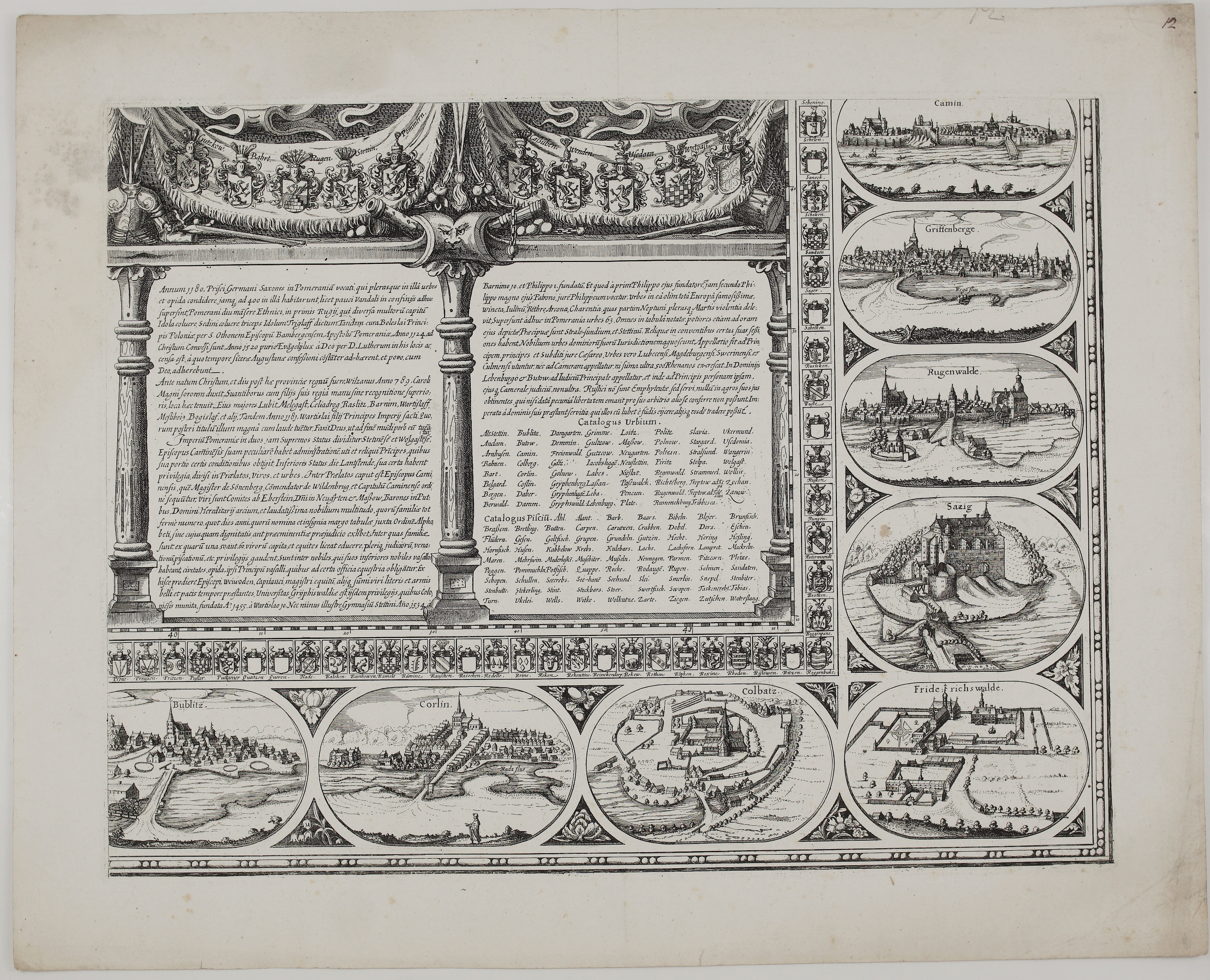
Sheet 12: the lower right corner. A draped banner carries the arms of the Pomeranian lands above the history of Pomerania, from its conversion by St Otto of Bamberg to the Reformation and the founding of the University of Greifswald. It also gives a “Catalogus Urbium” listing the towns of the duchy and a “Catalogus Piscium” listing the fish of its waters. Around it are views of Cammin, Greifenberg, Rügenwalde, Saatzig, Bublitz, Körlin, Kolbatz and Friedrichswalde.
Every sheet is framed by bands of noble coats of arms with family names. A rare chance to own a substantial part of the most important early map of Pomerania, now divided between Germany and Poland.
Cartographer: Eilhard Lubinus (1565 – 1621)
Engraver: Nicolaes Geilkercken (c. 1585 – 1657)
Publisher: Eilhard Lubinus
Leaf size: 64,0 x 52,0 cm (each sheet)
Year: 1758 (plates engraved 1618)
Technique: copper engraving
Condition:
Good condition. Six separate sheets with strong, dark impressions and wide margins; borders lightly outlined in yellow on two sheets. Light soiling and some spotting in the margins, a few marginal stains; sheet numbers in pencil in the upper right corners.
This is an original antique map published circa 1726 and NOT a modern copy or reprint
On your request I will provide a Certificate of Authenticity
In stock