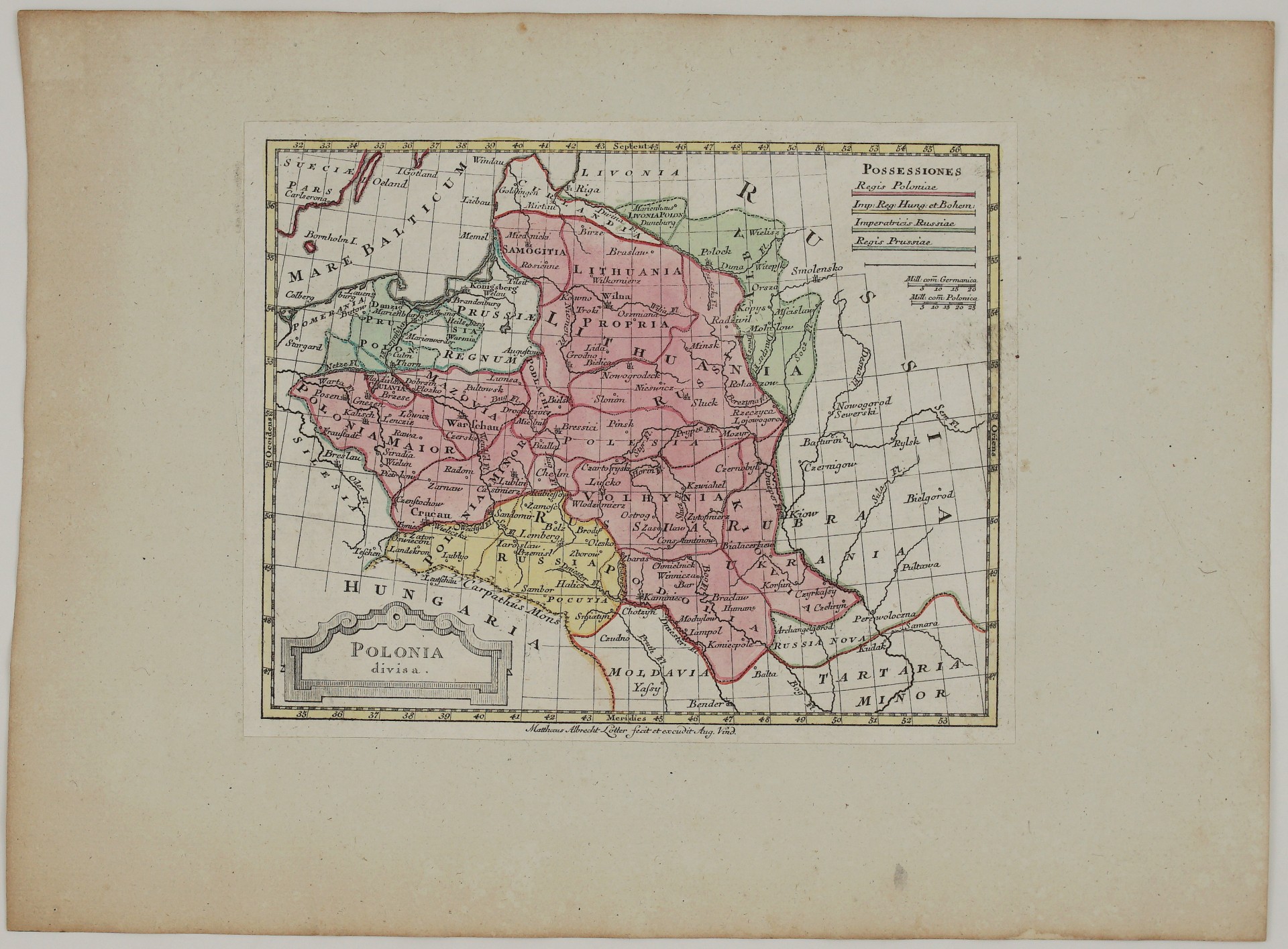
1785 – M. A. Lotter – Polonia divisa
450 €
Title: “Polonia divisa”
(Poland divided)
Description:
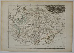
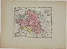
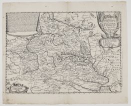
A rare small map of the Polish-Lithuanian Commonwealth after the First Partition of 1772, published in Augsburg by Matthäus Albrecht Lotter. As its blunt title says, it was made to show how Poland had been divided. The key in the upper right, “Possessiones”, explains the colours. They show the lands of the King of Poland and the shares taken by Poland’s three neighbours:
- Red: the King of Poland (“Regis Poloniae”). Poland and Lithuania are still the largest state in the region.
- Yellow: the Empress-Queen of Hungary and Bohemia (“Imp. Reg. Hung. et Bohem.”), that is, Maria Theresa of Austria. Her share is Galicia, with Lemberg (Lviv), Przemyśl, Halicz and Zamość.
- Green: the Empress of Russia (“Imperatricis Russiae”), Catherine the Great. Russia took Polish Livonia, with Dünaburg (Daugavpils), and the lands of Polotsk, Vitebsk, Mstislavl and Mogilev in present-day Belarus.
- Blue: the King of Prussia (“Regis Prussiae”), Frederick the Great. He took Royal Prussia and Warmia, which linked Brandenburg to East Prussia.
The Grand Duchy of Lithuania fills the upper half of the map, from Samogitia and Vilnius (“Wilna”), Kaunas, Trakai and Grodno to Minsk, Pinsk and the marshes of Polesia. To the south are Volhynia, Podolia and the Ukraine, stretching towards the Black Sea steppe, “Tartaria Minor”. In the lower left is a simple architectural cartouche with the title, and in the upper right two scales in German and Polish miles. The imprint below the map reads “Matthaeus Albrecht Lotter fecit et excudit Aug. Vind.” (made and published by Matthäus Albrecht Lotter, Augsburg).
The map was published between the First Partition of 1772 and the Second of 1793. Within little more than twenty years, the Commonwealth shown in red had vanished from the map altogether.
Matthäus Albrecht Lotter (1741–1810) was the son of Tobias Conrad Lotter and the grandson of Matthäus Seutter. He continued the family’s Augsburg map business, one of the leading German map publishers of the 18th century.
Cartographer: Matthäus Albrecht Lotter (1741–1810)
Sheet size: 32,7 x 24,0 cm
Year: 1785
Technique: copper engraving
Condition:
Good condition, contemporary hand coloring. The map is pasted on hand made paper.
This is an original antique map published in 1785 and NOT a modern copy or reprint
On your request I will provide a Certificate of Authenticity
In stock