1804 – F. L. Schrötter – Alt Preussen (10 maps)

$2,575.00

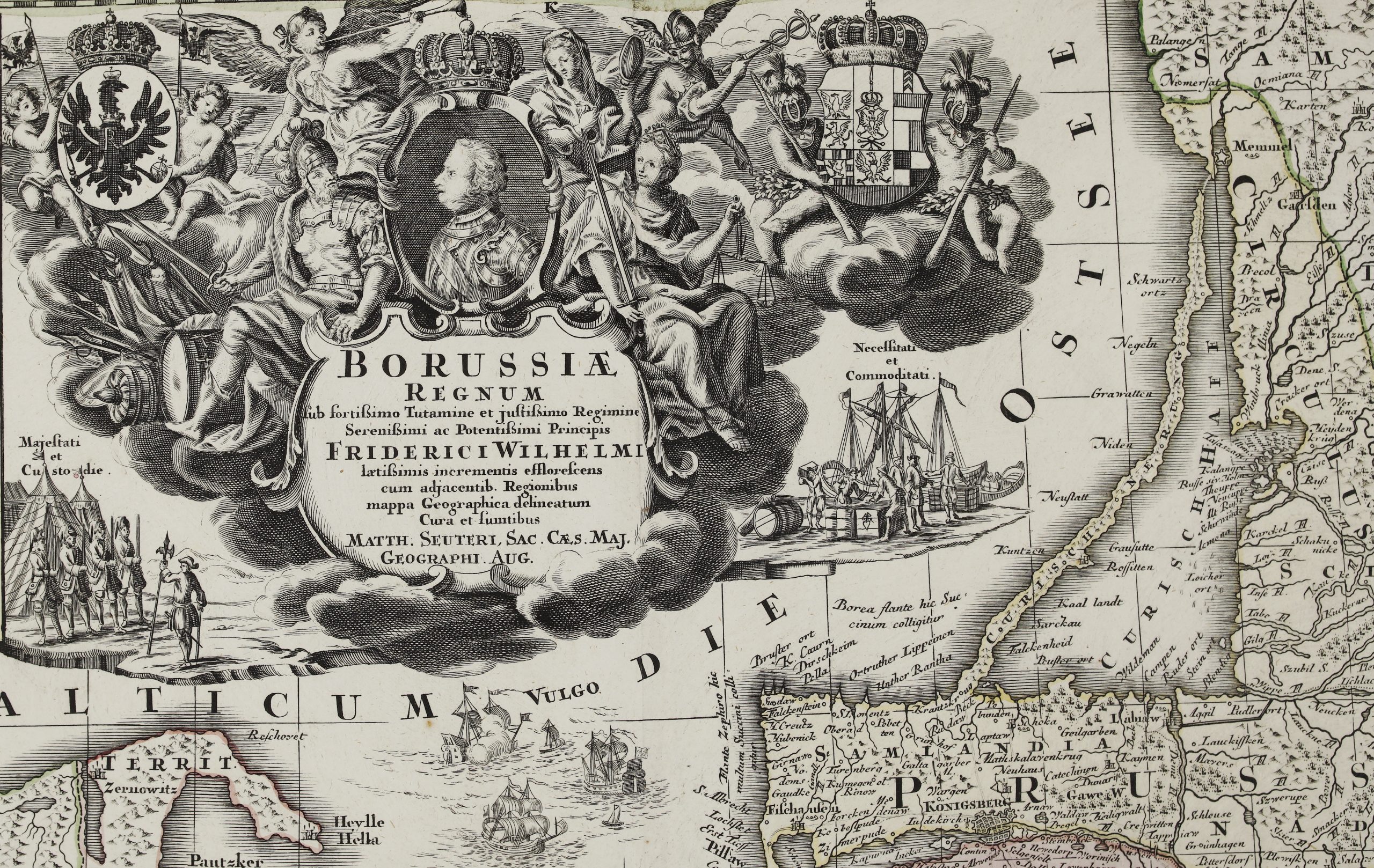
Title:                      “Karte von Alt-Preussen enthaltend Ost=Preusen nebst Preussisch Lithauen. . . 1796 bis 1802.​”​
​​

Description:
Very rare and extremely detailed 10 sheets map of Prussia (out of 25 sheets), our days Lithuania (Klaipeda, former Memel, region), Russia and Poland territories. With a medallion representing the King of Prussia Friedrich Wilhelm III. This is the rare, first edition, of this important 25-sheet map prepared by Friedrich Leopold von Schrötter.

Map represents a great topographic survey of Germany, Poland and Lithuania, Known as the “Die Schroetterche Landesaufnahme”, it is also a highly detailed economic and military map from the era of the Napoleonic Wars and it is important to Prussian annexation of the territory as well as having great utility for administrative purposes. Map representing cities, towns, villages, churches, waterways, battlefields, forests and pasture land, post offices, stations and stages for changing post riders and types of roads. It shows numerous facilities for industrial production, including windmills, paper mills, foundries, textile mills etc. Relief shown by hachures.

In 1796 under the leadership of Friedrich Leopold von Schröter (1743-1815) a mapping of East Prussia in scale 1:50000 was started. The work completed in 1802, set of maps “Karte von den Provinzen Litthauen, Ost und West Preussen u.d. Netz Distrikte auf befehl Ihrer Majestäten des Königs Friedrich Wilhelm II und Friedrich Wilhelm III auf Antrag des Staats Ministers und Departements Chefs Freiherrn von Schrötter in den Jahren 1796 bis 1802 vermessen und topographisch aufgenommen von Friedrich Bernhard Engelhardt Königlichem Kriegs und Domainen Rathe und Ban Director in Neu-Ost-Preussen” was created.
Based on this mapping in 1802 a set of maps “Karte von Alt-Preussen enthaltend Ost=Preusen nebst Preussisch Lithauen. . .” was issued, but the title of the map was quickly changed to “Karte von Ost-Preussen nebst Preussisch Litthauen und West – Preussen nebst dem Netzdistrict” and the title of the King was also changed in the second state.

Several engravers worked on the different sheets: Carl Jäck (I-III, V-VII, X-XII, XV, XVI, XVIIII, XXII, 1802-1806), Carl Mare (XIII-XV, XVII, XIX, XXII, XXV, 1806-1810), Heinrich Kliewer (IV, XXIV, 1803), Franz (XX, XXI), Paulus Schmidt (VIII, XXIII, town plans).

Published by Schropp & Co. in Berlin 1804.


Cartographer:      Friedrich Leopold von Schrötter (1743 – 1815)
Leaf size:                 10* 48 x 62 cm
Year:                          1804
Technique:             copper engraving

Condition:
Good condition. Rare issue, NOT intersected and pasted on linen. For protective reasons margin edges were reinforced with red paper stripes (old times).


This are an original antique maps published in 1804 and not a modern copy or reprint.


On your request I will provide a Certificate of Authenticity

In stock


Exclusive Maps