1749 – J. B. Homann – Romano – Germanici
150 €
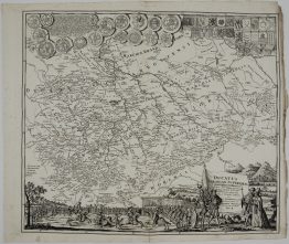
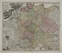
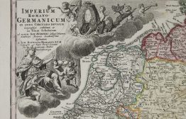
Title: “Imperii Romano-Germanici in suos Status et Circulos Divisi Tabula Generalis in Ustus Iuventutis Erudiendae…” & “L’ Allemagne, distinguee en ses Cercles & subdivisee en ses Etats, contenant … los Elements de Geographiae de Mr. Shatz…”
Description:
Very decorative map showing Germany, Austria, Bohemia and parts of the Low Countries with its political borders hand colored when published in outline and was belonging to the Holy-Roman-Empire. The map includes parts of the neighboring countries as France, Switzerland, Northern Italy, Prussia, Poland and Hungary. A detailed antique map with many engraved place names, rivers, lakes, mountains. In the upper left corner with decorative title cartouche showing the emperor of the Holy-Roman-Empire (Karl VII.) surrounded by puttees and above the eagle of the Holy Roman Empire.
The map comes from the Johann Baptist Homann atlas “Maior Atlas Scholasticus ex Triginta Sex Generalibus et Specialibus…“ drawn Tobias Mayer and published by Homann Heirs in Nuremberg 1749.
Cartographer: Johann Baptist Homann (1664-1724)
Sheet size: 60,6 x 53,0 cm
Year: 1749
Technique: copper engraving
Condition:
Good condition. Original contemporary coloring, strong press and on heavy paper, verso old times reinforcement. Lower center fold small marginal separation.
This is an original antique map published in 1749 and NOT a modern copy or reprint
On your request I will provide a Certificate of Authenticity
In stock