

1746 – Homann Erben – Europa in Partes
5,500 €
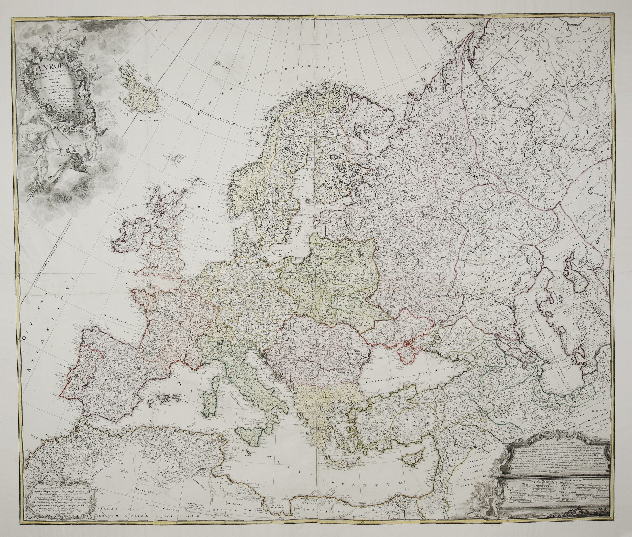
Title: “Europa in partes suas X methodicas a primariis regnis denominatas divisa secundum fidem recentissimarum observationum Mathematicarum et Historicarum, et exhibita secundum legitimas projectionis Stereographicae leges, a Ioh. Matth. Hasio Math. P.P.O. Impensas facientibus Haeredibus Homanianis.”
(Europe divided into its ten methodical parts, named after its principal kingdoms, according to the most recent mathematical and historical observations, and drawn according to the proper laws of the stereographic projection, by Johann Matthias Hase, Professor of Mathematics. Published at the expense of the Homann Heirs.)
Description:
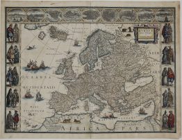
A monumental and extremely rare four-sheet wall map of Europe by Johann Matthias Hase (1684–1742), professor of mathematics at Wittenberg. It was published by the Homann Heirs in Nuremberg around 1746. Hase was the Homann firm’s leading scientific cartographer and drew his maps of the continents on the stereographic projection. This wall map is a far larger and more detailed work than his familiar one-sheet map of Europe of 1743. Wall maps were hung in offices, schools and libraries and used until they wore out, so very few have survived.
The map reaches far beyond the usual limits of Europe. In the west it starts at Iceland and the Atlantic, and in the east it runs to the Yenisei in Siberia, Novaya Zemlya and the Caspian Sea. To the south it crosses the Mediterranean to take in North Africa from Morocco to Egypt, as well as Syria and Mesopotamia as far as Baghdad. State borders are in contemporary outline colour. The Polish-Lithuanian Commonwealth is outlined from the Baltic coast to Podolia, with Prussia, Warmia, Volhynia and Halitia named inside it.
Three engraved cartouches show the scientific ambition of the map:
- Title cartouche (upper left). Fame blows her trumpet above a frame hung with royal crowns, together with a papal tiara and a turban. Below, Europa sits enthroned with a book, while putti and a kneeling figure in a feathered headdress bring her tribute. It is signed by the engraver J.C. Reinsperger.
- Key to enclaves (lower left). This explains the letters marking places that belonged to one state but lay inside another. Examples include Landau and Philippsburg (France), Crema (Venice), Lauenburg and Draheim (Poland), and Maastricht and Venlo (Dutch Republic), along with the territories of the German Imperial Circles.
- Scales cartouche (lower right). It gives eleven scales of European distance measures: German miles, three kinds of French league, Italian, Spanish, English statute, Swedish, Hungarian and Turkish miles, and Russian versts. Above them, Hase adds a Latin note warning that on a stereographic map this large no single scale is accurate everywhere. He explains how to measure long distances with a proportional compass, using the distance from Kazan to Astrakhan as his example. Putti with surveying instruments sit beside it.
Cartographer: Johann Matthias Hase (1684–1742)
Engravers: J.C. Reinsperger (title cartouche), Seligmann (scales cartouche)
Publisher: Homann Erben (1724-1780)
Sheet size: 120×102 cm
Year: 1746
Technique: copper engraving
Condition:
Good. Contemporary outline colour. Four sheets joined and professionally restored, with extended margins and a few small spots. The upper margin is mounted on acid-free board. The board can be removed so the map can be rolled and shipped in a tube.
This is an original antique map published in 1746 and not a modern copy or reprint
On your request I will provide a Certificate of Authenticity
In stock